You are here: Home > Network List > TA - USArray Transportable Network (new EarthScope stations) Stations List
> Station U59A Littleton, NC, USA > Earthquake Result Viewer
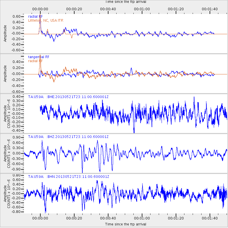
U59A Littleton, NC, USA - Earthquake Result Viewer
*The percent match for this event was below the threshold and hence no stack was calculated.
| Earthquake location: |
Central Peru |
| Earthquake latitude/longitude: |
-13.8/-72.3 |
| Earthquake time(UTC): |
2013/05/21 (141) 23:02:45 GMT |
| Earthquake Depth: |
92 km |
| Earthquake Magnitude: |
5.8 MW, 5.7 MB, 5.8 MW |
| Earthquake Catalog/Contributor: |
NEIC PDE/NEIC PDE-W |
|
| Network: |
TA USArray Transportable Network (new EarthScope stations) |
| Station: |
U59A Littleton, NC, USA |
| Lat/Lon: |
36.35 N/77.79 W |
| Elevation: |
99 m |
|
| Distance: |
50.1 deg |
| Az: |
354.184 deg |
| Baz: |
172.995 deg |
| Ray Param: |
$rayparam |
*The percent match for this event was below the threshold and hence was not used in the summary stack. |
|
| Radial Match: |
66.96231 % |
| Radial Bump: |
400 |
| Transverse Match: |
58.507656 % |
| Transverse Bump: |
400 |
| SOD ConfigId: |
512894 |
| Insert Time: |
2013-09-14 15:33:44.811 +0000 |
| GWidth: |
2.5 |
| Max Bumps: |
400 |
| Tol: |
0.001 |
|
Signal To Noise
| Channel | StoN | STA | LTA |
| TA:U59A: :BHZ:20130521T23:11:00.600001Z | 4.523525 | 4.0965804E-7 | 9.0561684E-8 |
| TA:U59A: :BHN:20130521T23:11:00.600001Z | 2.9449997 | 3.0219678E-7 | 1.0261352E-7 |
| TA:U59A: :BHE:20130521T23:11:00.600001Z | 1.0842208 | 9.8261644E-8 | 9.0628824E-8 |
| Arrivals |
| Ps | |
| PpPs | |
| PsPs/PpSs | |


