TSK Tsukuba, Japan - Earthquake Result Viewer
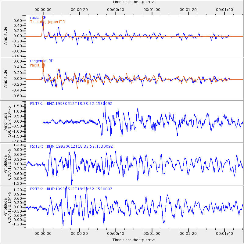
Earthquake location: Irian Jaya Region, Indonesia
Earthquake latitude/longitude: -4.4/135.1
Earthquake time(UTC): 1993/06/12 (163) 18:26:45 GMT
Earthquake Depth: 33 km
Earthquake Magnitude: 5.8 MB, 6.1 MS, 6.2 UNKNOWN, 6.2 MW
Earthquake Catalog/Contributor: WHDF/NEIC
Network: PS Pacific21
Station: TSK Tsukuba, Japan
Lat/Lon: 36.21 N/140.11 E
Elevation: 350 m
Distance: 40.7 deg
Az: 6.284 deg
Baz: 187.756 deg
Ray Param: 0.07420977
Estimated Moho Depth: 19.25 km
Estimated Crust Vp/Vs: 1.96
Assumed Crust Vp: 6.24 km/s
Estimated Crust Vs: 3.184 km/s
Estimated Crust Poisson's Ratio: 0.32
Radial Match: 84.01575 %
Radial Bump: 400
Transverse Match: 77.1196 %
Transverse Bump: 400
SOD ConfigId: 16938
Insert Time: 2010-02-27 03:51:08.927 +0000
GWidth: 2.5
Max Bumps: 400
Tol: 0.001

Signal To Noise

ChannelStoNSTALTA
PS:TSK: :BHN:19930612T18:33:52.153009Z5.58121544.3886686E-77.863285E-8
PS:TSK: :BHE:19930612T18:33:52.153009Z4.0516532.8928534E-77.1399334E-8
PS:TSK: :BHZ:19930612T18:33:52.153009Z8.0479077.987049E-79.92438E-8
Arrivals
Ps3.1 SECOND
PpPs8.6 SECOND
PsPs/PpSs12 SECOND