You are here: Home > Network List > US - United States National Seismic Network Stations List
> Station ACSO Alum Creek State Park, Ohio, USA > Earthquake Result Viewer
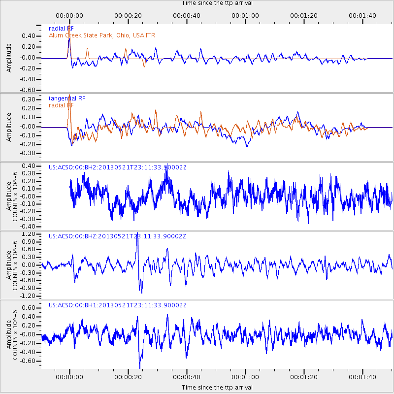
ACSO Alum Creek State Park, Ohio, USA - Earthquake Result Viewer
*The percent match for this event was below the threshold and hence no stack was calculated.
| Earthquake location: |
Central Peru |
| Earthquake latitude/longitude: |
-13.8/-72.3 |
| Earthquake time(UTC): |
2013/05/21 (141) 23:02:45 GMT |
| Earthquake Depth: |
92 km |
| Earthquake Magnitude: |
5.8 MW, 5.7 MB, 5.8 MW |
| Earthquake Catalog/Contributor: |
NEIC PDE/NEIC PDE-W |
|
| Network: |
US United States National Seismic Network |
| Station: |
ACSO Alum Creek State Park, Ohio, USA |
| Lat/Lon: |
40.23 N/82.98 W |
| Elevation: |
288 m |
|
| Distance: |
54.7 deg |
| Az: |
349.947 deg |
| Baz: |
167.201 deg |
| Ray Param: |
$rayparam |
*The percent match for this event was below the threshold and hence was not used in the summary stack. |
|
| Radial Match: |
57.88352 % |
| Radial Bump: |
400 |
| Transverse Match: |
45.679134 % |
| Transverse Bump: |
400 |
| SOD ConfigId: |
512894 |
| Insert Time: |
2013-09-14 15:38:01.919 +0000 |
| GWidth: |
2.5 |
| Max Bumps: |
400 |
| Tol: |
0.001 |
|
Signal To Noise
| Channel | StoN | STA | LTA |
| US:ACSO:00:BHZ:20130521T23:11:33.90002Z | 4.8524165 | 2.6823466E-7 | 5.5278573E-8 |
| US:ACSO:00:BH1:20130521T23:11:33.90002Z | 1.5311748 | 1.822182E-7 | 1.19005485E-7 |
| US:ACSO:00:BH2:20130521T23:11:33.90002Z | 1.3055061 | 1.6543524E-7 | 1.2672115E-7 |
| Arrivals |
| Ps | |
| PpPs | |
| PsPs/PpSs | |


