TSK Tsukuba, Japan - Earthquake Result Viewer
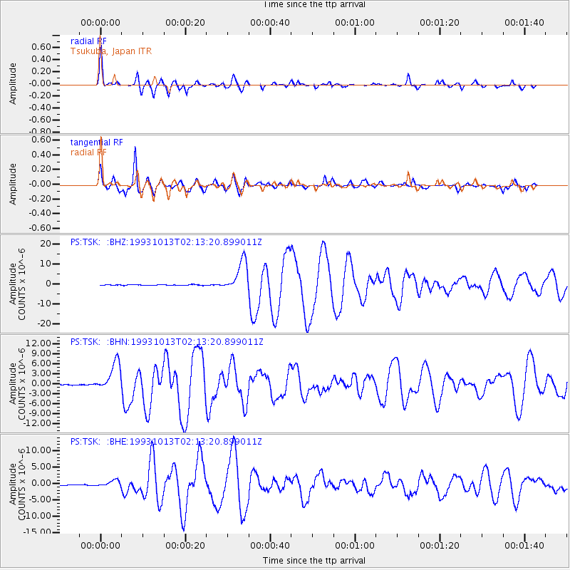
Earthquake location: Eastern New Guinea Reg., P.N.G.
Earthquake latitude/longitude: -5.9/146.0
Earthquake time(UTC): 1993/10/13 (286) 02:06:00 GMT
Earthquake Depth: 24 km
Earthquake Magnitude: 6.4 MB, 7.1 MS, 6.7 UNKNOWN, 7.1 ML
Earthquake Catalog/Contributor: WHDF/NEIC
Network: PS Pacific21
Station: TSK Tsukuba, Japan
Lat/Lon: 36.21 N/140.11 E
Elevation: 350 m
Distance: 42.3 deg
Az: 352.879 deg
Baz: 171.23 deg
Ray Param: 0.07322774
Estimated Moho Depth: 19.25 km
Estimated Crust Vp/Vs: 2.10
Assumed Crust Vp: 6.24 km/s
Estimated Crust Vs: 2.975 km/s
Estimated Crust Poisson's Ratio: 0.35
Radial Match: 90.928055 %
Radial Bump: 400
Transverse Match: 85.49974 %
Transverse Bump: 400
SOD ConfigId: 16938
Insert Time: 2010-02-27 03:51:31.520 +0000
GWidth: 2.5
Max Bumps: 400
Tol: 0.001

Signal To Noise

ChannelStoNSTALTA
PS:TSK: :BHN:19931013T02:13:20.899011Z33.4753574.5514385E-61.3596384E-7
PS:TSK: :BHE:19931013T02:13:20.899011Z6.78431751.0225415E-61.5072133E-7
PS:TSK: :BHZ:19931013T02:13:20.899011Z48.2777028.187225E-61.6958604E-7
Arrivals
Ps3.6 SECOND
PpPs9.1 SECOND
PsPs/PpSs13 SECOND