TSK Tsukuba, Japan - Earthquake Result Viewer
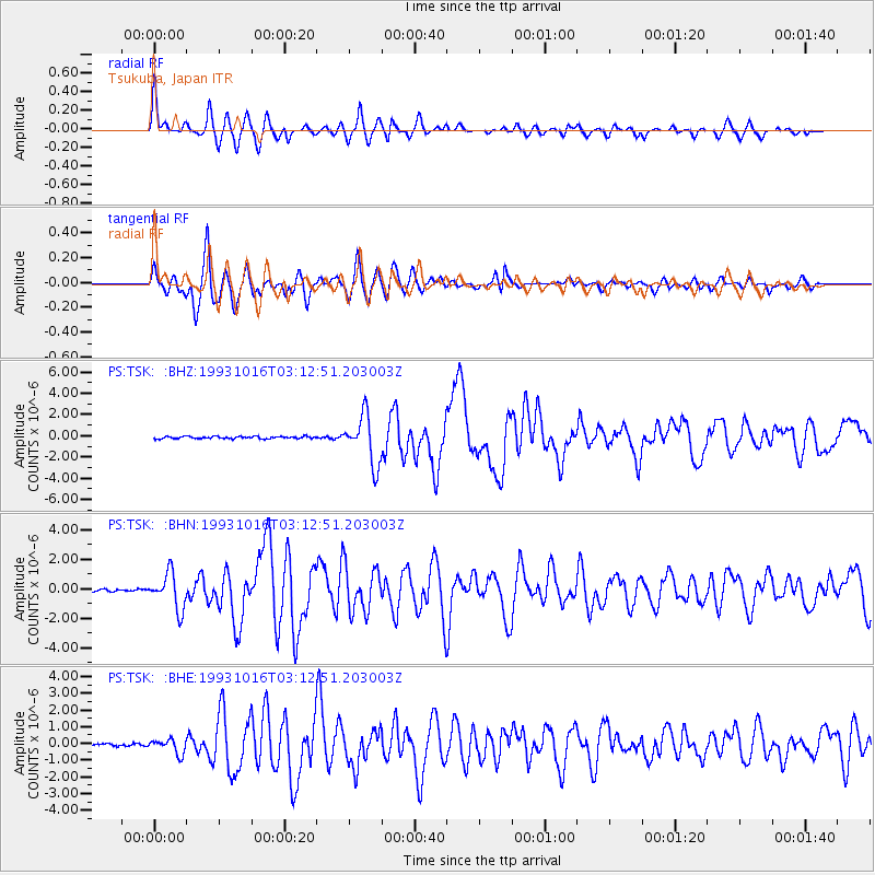
Earthquake location: Eastern New Guinea Reg., P.N.G.
Earthquake latitude/longitude: -5.9/146.2
Earthquake time(UTC): 1993/10/16 (289) 03:05:31 GMT
Earthquake Depth: 33 km
Earthquake Magnitude: 6.2 MB, 6.4 MS, 6.5 UNKNOWN, 6.3 MW
Earthquake Catalog/Contributor: WHDF/NEIC
Network: PS Pacific21
Station: TSK Tsukuba, Japan
Lat/Lon: 36.21 N/140.11 E
Elevation: 350 m
Distance: 42.3 deg
Az: 352.677 deg
Baz: 170.98 deg
Ray Param: 0.07318149
Estimated Moho Depth: 33.25 km
Estimated Crust Vp/Vs: 1.85
Assumed Crust Vp: 6.24 km/s
Estimated Crust Vs: 3.373 km/s
Estimated Crust Poisson's Ratio: 0.29
Radial Match: 85.955696 %
Radial Bump: 400
Transverse Match: 82.83507 %
Transverse Bump: 400
SOD ConfigId: 16938
Insert Time: 2010-02-27 03:51:34.578 +0000
GWidth: 2.5
Max Bumps: 400
Tol: 0.001

Signal To Noise

ChannelStoNSTALTA
PS:TSK: :BHN:19931016T03:12:51.203003Z15.2244431.2080554E-67.934973E-8
PS:TSK: :BHE:19931016T03:12:51.203003Z6.8164744.3471002E-76.377344E-8
PS:TSK: :BHZ:19931016T03:12:51.203003Z22.3923762.2878244E-61.02169786E-7
Arrivals
Ps4.8 SECOND
PpPs14 SECOND
PsPs/PpSs19 SECOND