You are here: Home > Network List > II - Global Seismograph Network (GSN - IRIS/IDA) Stations List
> Station MBAR Mbarara, Uganda > Earthquake Result Viewer
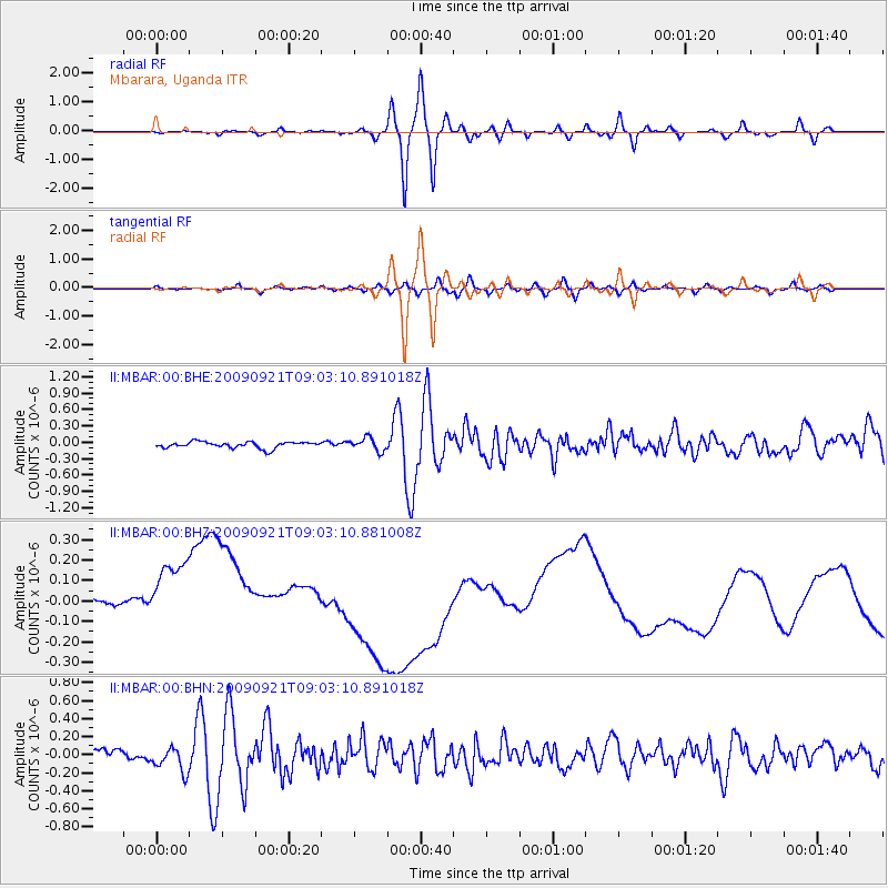
MBAR Mbarara, Uganda - Earthquake Result Viewer
*The percent match for this event was below the threshold and hence no stack was calculated.
| Earthquake location: |
Bhutan |
| Earthquake latitude/longitude: |
27.3/91.4 |
| Earthquake time(UTC): |
2009/09/21 (264) 08:53:05 GMT |
| Earthquake Depth: |
14 km |
| Earthquake Magnitude: |
6.1 MB, 6.1 MS, 6.1 MW, 6.1 MW |
| Earthquake Catalog/Contributor: |
WHDF/NEIC |
|
| Network: |
II Global Seismograph Network (GSN - IRIS/IDA) |
| Station: |
MBAR Mbarara, Uganda |
| Lat/Lon: |
0.60 S/30.74 E |
| Elevation: |
1390 m |
|
| Distance: |
64.5 deg |
| Az: |
255.053 deg |
| Baz: |
59.267 deg |
| Ray Param: |
$rayparam |
*The percent match for this event was below the threshold and hence was not used in the summary stack. |
|
| Radial Match: |
77.42977 % |
| Radial Bump: |
400 |
| Transverse Match: |
53.04669 % |
| Transverse Bump: |
400 |
| SOD ConfigId: |
1 |
| Insert Time: |
2010-02-19 00:17:29.976 +0000 |
| GWidth: |
2.5 |
| Max Bumps: |
400 |
| Tol: |
0.001 |
|
Signal To Noise
| Channel | StoN | STA | LTA |
| II:MBAR:00:BHZ:20090921T09:03:10.881008Z | 1.2725914 | 3.7377552E-7 | 2.9371213E-7 |
| II:MBAR:00:BHN:20090921T09:03:10.891018Z | 2.1426978 | 1.339819E-7 | 6.252954E-8 |
| II:MBAR:00:BHE:20090921T09:03:10.891018Z | 2.0337532 | 1.1798911E-7 | 5.8015456E-8 |
| Arrivals |
| Ps | |
| PpPs | |
| PsPs/PpSs | |


