TSK Tsukuba, Japan - Earthquake Result Viewer
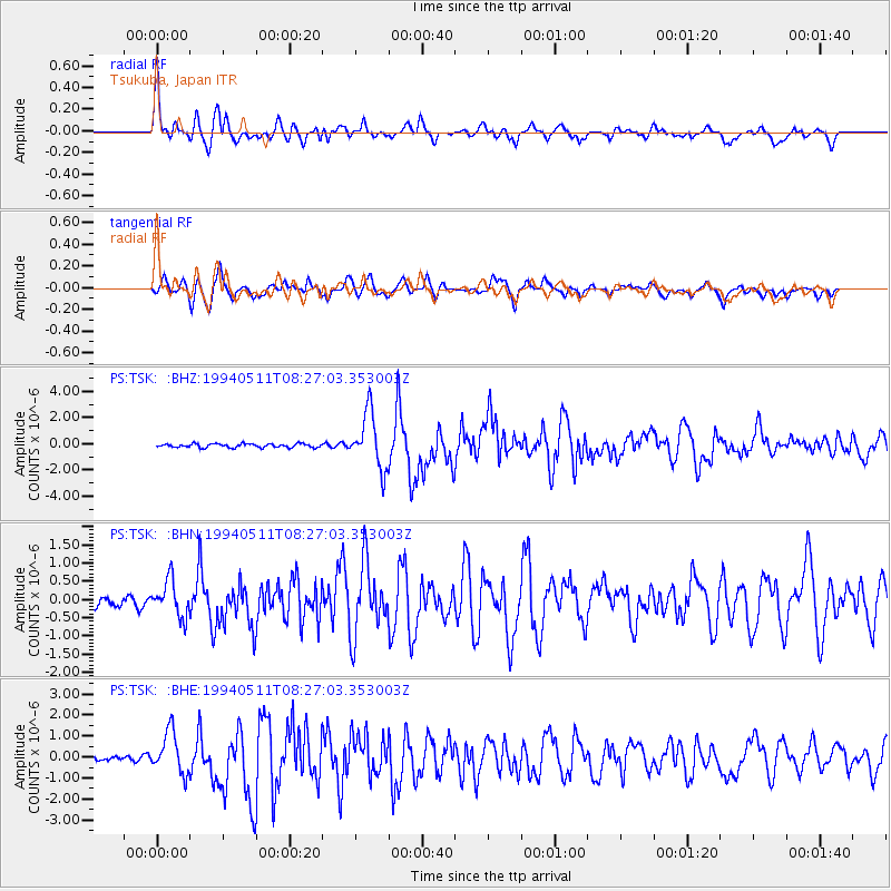
Earthquake location: Southern Sumatra, Indonesia
Earthquake latitude/longitude: -2.0/99.8
Earthquake time(UTC): 1994/05/11 (131) 08:18:16 GMT
Earthquake Depth: 28 km
Earthquake Magnitude: 6.0 MB, 6.3 MS, 6.0 UNKNOWN, 6.3 MW
Earthquake Catalog/Contributor: WHDF/NEIC
Network: PS Pacific21
Station: TSK Tsukuba, Japan
Lat/Lon: 36.21 N/140.11 E
Elevation: 350 m
Distance: 53.4 deg
Az: 40.659 deg
Baz: 233.626 deg
Ray Param: 0.066065505
Estimated Moho Depth: 22.25 km
Estimated Crust Vp/Vs: 1.73
Assumed Crust Vp: 6.24 km/s
Estimated Crust Vs: 3.602 km/s
Estimated Crust Poisson's Ratio: 0.25
Radial Match: 86.22235 %
Radial Bump: 400
Transverse Match: 76.44848 %
Transverse Bump: 400
SOD ConfigId: 16938
Insert Time: 2010-02-27 03:51:59.404 +0000
GWidth: 2.5
Max Bumps: 400
Tol: 0.001

Signal To Noise

ChannelStoNSTALTA
PS:TSK: :BHN:19940511T08:27:03.353003Z4.2665674.943223E-71.15859486E-7
PS:TSK: :BHE:19940511T08:27:03.353003Z8.23850259.994023E-71.2130873E-7
PS:TSK: :BHZ:19940511T08:27:03.353003Z14.7712162.11145E-61.4294353E-7
Arrivals
Ps2.8 SECOND
PpPs9.2 SECOND
PsPs/PpSs12 SECOND