You are here: Home > Network List > AV - Alaska Volcano Observatory Stations List
> Station MAPS Pakushin Southeast, Makushin Volcano, Alaska > Earthquake Result Viewer
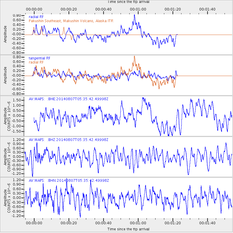
MAPS Pakushin Southeast, Makushin Volcano, Alaska - Earthquake Result Viewer
*The percent match for this event was below the threshold and hence no stack was calculated.
| Earthquake location: |
Talaud Islands, Indonesia |
| Earthquake latitude/longitude: |
4.5/126.5 |
| Earthquake time(UTC): |
2014/08/07 (219) 05:24:54 GMT |
| Earthquake Depth: |
80 km |
| Earthquake Magnitude: |
5.1 MW, 5.1 mb |
| Earthquake Catalog/Contributor: |
ISC/ISC |
|
| Network: |
AV Alaska Volcano Observatory |
| Station: |
MAPS Pakushin Southeast, Makushin Volcano, Alaska |
| Lat/Lon: |
53.81 N/166.94 W |
| Elevation: |
333 m |
|
| Distance: |
72.6 deg |
| Az: |
34.759 deg |
| Baz: |
253.4 deg |
| Ray Param: |
$rayparam |
*The percent match for this event was below the threshold and hence was not used in the summary stack. |
|
| Radial Match: |
53.856766 % |
| Radial Bump: |
387 |
| Transverse Match: |
48.997147 % |
| Transverse Bump: |
400 |
| SOD ConfigId: |
3390531 |
| Insert Time: |
2019-04-13 05:51:42.706 +0000 |
| GWidth: |
2.5 |
| Max Bumps: |
400 |
| Tol: |
0.001 |
|
Signal To Noise
| Channel | StoN | STA | LTA |
| AV:MAPS: :BHZ:20140807T05:35:42.49998Z | 1.2890383 | 5.397862E-7 | 4.1875109E-7 |
| AV:MAPS: :BHN:20140807T05:35:42.49998Z | 0.86263853 | 3.0768493E-7 | 3.5667884E-7 |
| AV:MAPS: :BHE:20140807T05:35:42.49998Z | 1.3450454 | 6.701046E-7 | 4.982022E-7 |
| Arrivals |
| Ps | |
| PpPs | |
| PsPs/PpSs | |


