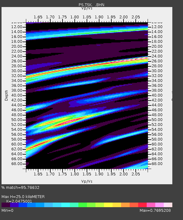
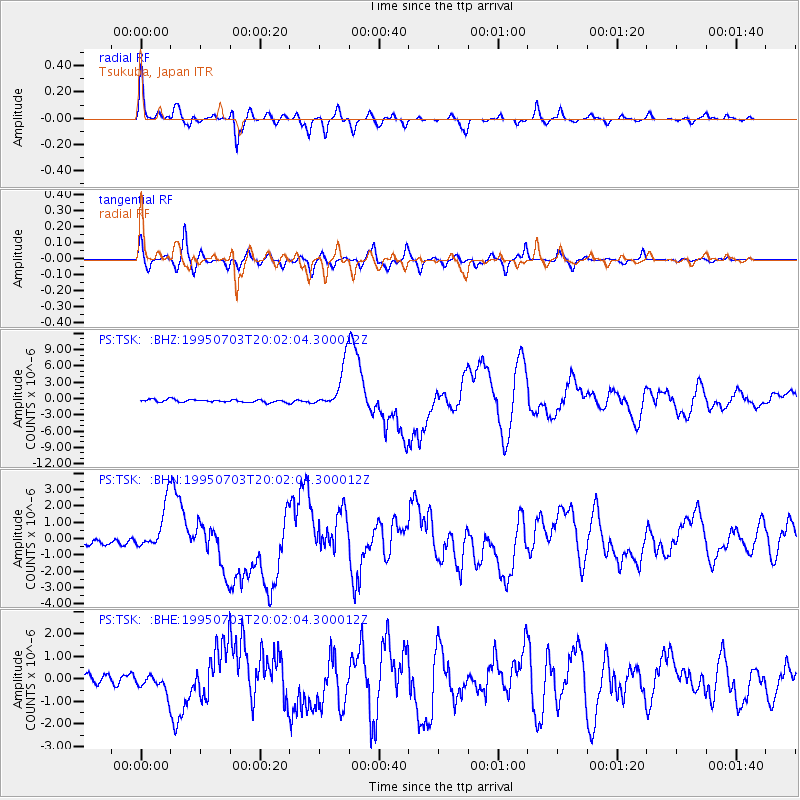
TSK Tsukuba, Japan - Earthquake Result Viewer

Earthquake location: Kermadec Islands, New Zealand
Earthquake latitude/longitude: -29.2/-177.6
Earthquake time(UTC): 1995/07/03 (184) 19:50:50 GMT
Earthquake Depth: 33 km
Earthquake Magnitude: 6.5 MB, 7.2 MS, 7.2 UNKNOWN, 7.2 MW
Earthquake Catalog/Contributor: WHDF/NEIC
Network: PS Pacific21
Station: TSK Tsukuba, Japan
Lat/Lon: 36.21 N/140.11 E
Elevation: 350 m
Distance: 76.2 deg
Az: 325.936 deg
Baz: 142.732 deg
Ray Param: 0.051074844
Estimated Moho Depth: 25.0 km
Estimated Crust Vp/Vs: 2.05
Assumed Crust Vp: 6.24 km/s
Estimated Crust Vs: 3.048 km/s
Estimated Crust Poisson's Ratio: 0.34
Radial Match: 95.76632 %
Radial Bump: 357
Transverse Match: 90.37489 %
Transverse Bump: 400
SOD ConfigId: 6273
Insert Time: 2010-02-27 03:52:38.872 +0000
GWidth: 2.5
Max Bumps: 400
Tol: 0.001

Signal To Noise

ChannelStoNSTALTA
PS:TSK: :BHN:19950703T20:02:04.300012Z7.7724591.4060192E-61.808976E-7
PS:TSK: :BHE:19950703T20:02:04.300012Z1.51693863.9201416E-72.5842454E-7
PS:TSK: :BHZ:19950703T20:02:04.300012Z16.3265044.15419E-62.5444456E-7
Arrivals
Ps4.3 SECOND
PpPs12 SECOND
PsPs/PpSs16 SECOND