TSK Tsukuba, Japan - Earthquake Result Viewer
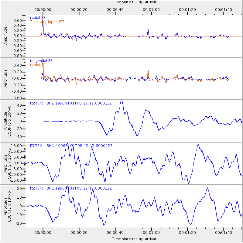
Earthquake location: Minahassa Peninsula, Sulawesi
Earthquake latitude/longitude: 0.7/120.0
Earthquake time(UTC): 1996/01/01 (001) 08:05:11 GMT
Earthquake Depth: 33 km
Earthquake Magnitude: 6.2 MB, 7.7 MS, 7.8 UNKNOWN, 7.8 MW
Earthquake Catalog/Contributor: WHDF/NEIC
Network: PS Pacific21
Station: TSK Tsukuba, Japan
Lat/Lon: 36.21 N/140.11 E
Elevation: 350 m
Distance: 39.9 deg
Az: 25.688 deg
Baz: 212.408 deg
Ray Param: 0.07461693
Estimated Moho Depth: 40.5 km
Estimated Crust Vp/Vs: 1.90
Assumed Crust Vp: 6.24 km/s
Estimated Crust Vs: 3.276 km/s
Estimated Crust Poisson's Ratio: 0.31
Radial Match: 89.44168 %
Radial Bump: 314
Transverse Match: 74.24017 %
Transverse Bump: 400
SOD ConfigId: 6273
Insert Time: 2010-02-27 03:54:05.475 +0000
GWidth: 2.5
Max Bumps: 400
Tol: 0.001

Signal To Noise

ChannelStoNSTALTA
PS:TSK: :BHN:19960101T08:12:12.600012Z11.1062455.9416125E-65.349794E-7
PS:TSK: :BHE:19960101T08:12:12.600012Z10.2841366.6407397E-66.457266E-7
PS:TSK: :BHZ:19960101T08:12:12.600012Z25.0828551.4278157E-55.692397E-7
Arrivals
Ps6.2 SECOND
PpPs18 SECOND
PsPs/PpSs24 SECOND