TSK Tsukuba, Japan - Earthquake Result Viewer
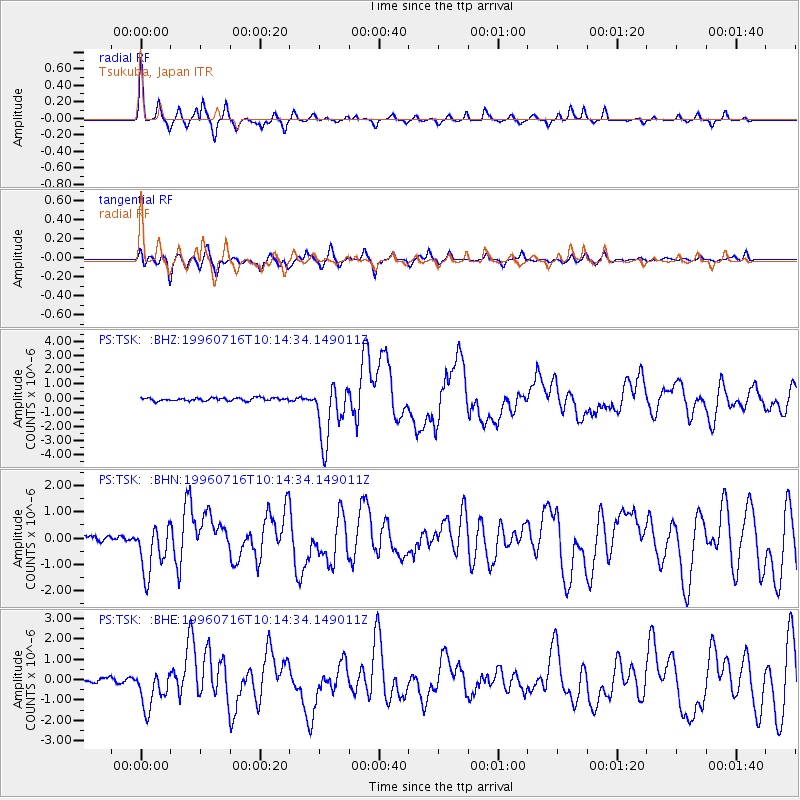
Earthquake location: Minahassa Peninsula, Sulawesi
Earthquake latitude/longitude: 1.0/120.3
Earthquake time(UTC): 1996/07/16 (198) 10:07:36 GMT
Earthquake Depth: 33 km
Earthquake Magnitude: 6.0 MB, 6.4 MS, 6.6 UNKNOWN, 6.6 MW
Earthquake Catalog/Contributor: WHDF/NEIC
Network: PS Pacific21
Station: TSK Tsukuba, Japan
Lat/Lon: 36.21 N/140.11 E
Elevation: 350 m
Distance: 39.6 deg
Az: 25.547 deg
Baz: 212.219 deg
Ray Param: 0.074847706
Estimated Moho Depth: 22.75 km
Estimated Crust Vp/Vs: 1.77
Assumed Crust Vp: 6.24 km/s
Estimated Crust Vs: 3.525 km/s
Estimated Crust Poisson's Ratio: 0.27
Radial Match: 82.38156 %
Radial Bump: 235
Transverse Match: 63.40154 %
Transverse Bump: 399
SOD ConfigId: 6273
Insert Time: 2010-02-27 03:54:25.618 +0000
GWidth: 2.5
Max Bumps: 400
Tol: 0.001

Signal To Noise

ChannelStoNSTALTA
PS:TSK: :BHN:19960716T10:14:34.149011Z11.0517019.398482E-78.504105E-8
PS:TSK: :BHE:19960716T10:14:34.149011Z8.7771389.505289E-71.0829599E-7
PS:TSK: :BHZ:19960716T10:14:34.149011Z19.655572.0622529E-61.0491952E-7
Arrivals
Ps3.0 SECOND
PpPs9.4 SECOND
PsPs/PpSs12 SECOND