You are here: Home > Network List > TA - USArray Transportable Network (new EarthScope stations) Stations List
> Station U41A Viola, AR, USA > Earthquake Result Viewer
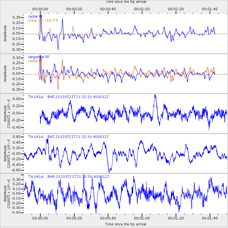
U41A Viola, AR, USA - Earthquake Result Viewer
*The percent match for this event was below the threshold and hence no stack was calculated.
| Earthquake location: |
Tonga Islands |
| Earthquake latitude/longitude: |
-20.6/-175.8 |
| Earthquake time(UTC): |
2013/05/23 (143) 21:07:46 GMT |
| Earthquake Depth: |
150 km |
| Earthquake Magnitude: |
6.3 MW, 5.7 MB, 6.3 MW |
| Earthquake Catalog/Contributor: |
NEIC PDE/NEIC PDE-W |
|
| Network: |
TA USArray Transportable Network (new EarthScope stations) |
| Station: |
U41A Viola, AR, USA |
| Lat/Lon: |
36.34 N/91.92 W |
| Elevation: |
300 m |
|
| Distance: |
97.2 deg |
| Az: |
54.003 deg |
| Baz: |
249.87 deg |
| Ray Param: |
$rayparam |
*The percent match for this event was below the threshold and hence was not used in the summary stack. |
|
| Radial Match: |
58.290894 % |
| Radial Bump: |
400 |
| Transverse Match: |
49.504025 % |
| Transverse Bump: |
400 |
| SOD ConfigId: |
512894 |
| Insert Time: |
2013-09-14 16:35:03.855 +0000 |
| GWidth: |
2.5 |
| Max Bumps: |
400 |
| Tol: |
0.001 |
|
Signal To Noise
| Channel | StoN | STA | LTA |
| TA:U41A: :BHZ:20130523T21:20:30.400012Z | 2.6510158 | 2.9569023E-7 | 1.1153847E-7 |
| TA:U41A: :BHN:20130523T21:20:30.400012Z | 0.77939624 | 1.07306576E-7 | 1.376791E-7 |
| TA:U41A: :BHE:20130523T21:20:30.400012Z | 0.9266782 | 1.2531967E-7 | 1.3523538E-7 |
| Arrivals |
| Ps | |
| PpPs | |
| PsPs/PpSs | |


