You are here: Home > Network List > G - GEOSCOPE Stations List
> Station INU Inuyama, Japan > Earthquake Result Viewer
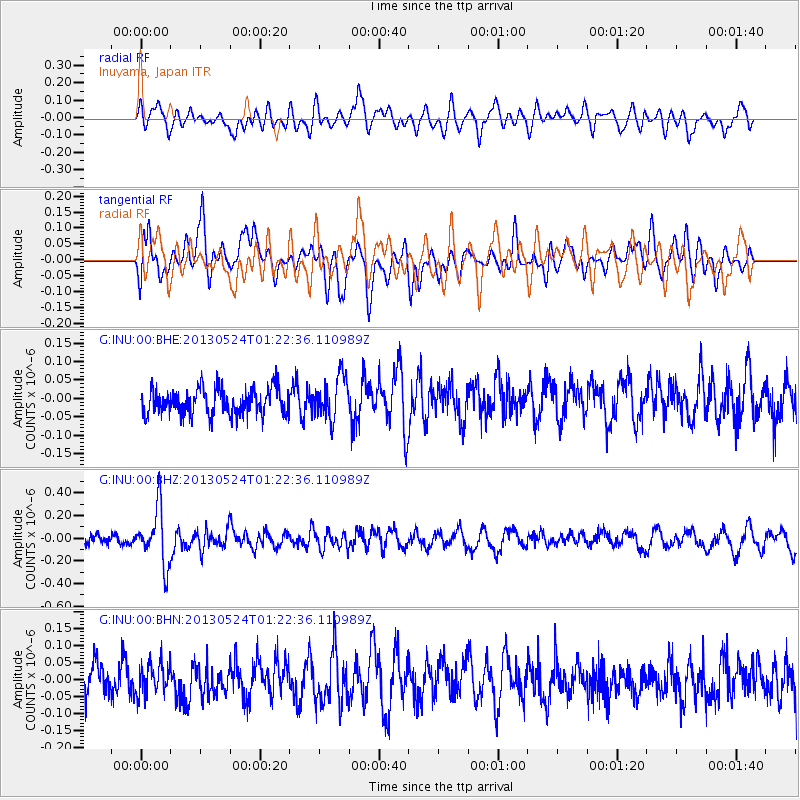
INU Inuyama, Japan - Earthquake Result Viewer
*The percent match for this event was below the threshold and hence no stack was calculated.
| Earthquake location: |
Macquarie Island Region |
| Earthquake latitude/longitude: |
-54.5/158.9 |
| Earthquake time(UTC): |
2013/05/24 (144) 01:10:01 GMT |
| Earthquake Depth: |
10 km |
| Earthquake Magnitude: |
5.6 MB |
| Earthquake Catalog/Contributor: |
NEIC PDE/NEIC PDE-W |
|
| Network: |
G GEOSCOPE |
| Station: |
INU Inuyama, Japan |
| Lat/Lon: |
35.35 N/137.03 E |
| Elevation: |
132 m |
|
| Distance: |
91.4 deg |
| Az: |
342.234 deg |
| Baz: |
167.418 deg |
| Ray Param: |
$rayparam |
*The percent match for this event was below the threshold and hence was not used in the summary stack. |
|
| Radial Match: |
58.791836 % |
| Radial Bump: |
400 |
| Transverse Match: |
67.20807 % |
| Transverse Bump: |
400 |
| SOD ConfigId: |
512894 |
| Insert Time: |
2013-09-14 16:40:47.584 +0000 |
| GWidth: |
2.5 |
| Max Bumps: |
400 |
| Tol: |
0.001 |
|
Signal To Noise
| Channel | StoN | STA | LTA |
| G:INU:00:BHZ:20130524T01:22:36.110989Z | 5.213611 | 2.4679355E-7 | 4.7336396E-8 |
| G:INU:00:BHN:20130524T01:22:36.110989Z | 0.90718096 | 4.516562E-8 | 4.978678E-8 |
| G:INU:00:BHE:20130524T01:22:36.110989Z | 1.6325611 | 5.7776976E-8 | 3.5390393E-8 |
| Arrivals |
| Ps | |
| PpPs | |
| PsPs/PpSs | |


