You are here: Home > Network List > IU - Global Seismograph Network (GSN - IRIS/USGS) Stations List
> Station CTAO Charters Towers, Australia > Earthquake Result Viewer
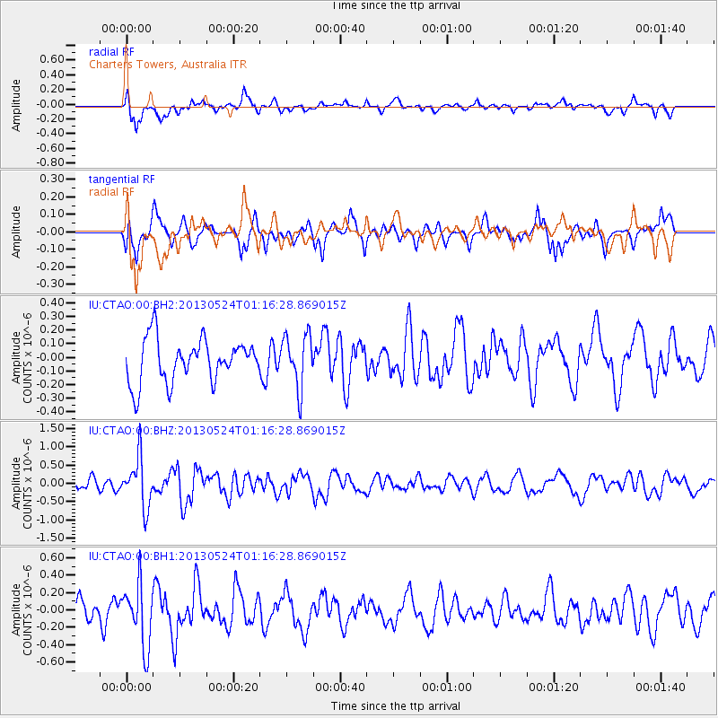
CTAO Charters Towers, Australia - Earthquake Result Viewer
*The percent match for this event was below the threshold and hence no stack was calculated.
| Earthquake location: |
Macquarie Island Region |
| Earthquake latitude/longitude: |
-54.5/158.9 |
| Earthquake time(UTC): |
2013/05/24 (144) 01:10:01 GMT |
| Earthquake Depth: |
10 km |
| Earthquake Magnitude: |
5.6 MB |
| Earthquake Catalog/Contributor: |
NEIC PDE/NEIC PDE-W |
|
| Network: |
IU Global Seismograph Network (GSN - IRIS/USGS) |
| Station: |
CTAO Charters Towers, Australia |
| Lat/Lon: |
20.09 S/146.25 E |
| Elevation: |
357 m |
|
| Distance: |
35.7 deg |
| Az: |
339.271 deg |
| Baz: |
167.304 deg |
| Ray Param: |
$rayparam |
*The percent match for this event was below the threshold and hence was not used in the summary stack. |
|
| Radial Match: |
64.002365 % |
| Radial Bump: |
400 |
| Transverse Match: |
65.46704 % |
| Transverse Bump: |
399 |
| SOD ConfigId: |
512894 |
| Insert Time: |
2013-09-14 16:42:27.237 +0000 |
| GWidth: |
2.5 |
| Max Bumps: |
400 |
| Tol: |
0.001 |
|
Signal To Noise
| Channel | StoN | STA | LTA |
| IU:CTAO:00:BHZ:20130524T01:16:28.869015Z | 3.169956 | 6.808159E-7 | 2.1477142E-7 |
| IU:CTAO:00:BH1:20130524T01:16:28.869015Z | 2.322084 | 3.6850622E-7 | 1.5869634E-7 |
| IU:CTAO:00:BH2:20130524T01:16:28.869015Z | 1.2399364 | 1.9609557E-7 | 1.581497E-7 |
| Arrivals |
| Ps | |
| PpPs | |
| PsPs/PpSs | |


