You are here: Home > Network List > TA - USArray Transportable Network (new EarthScope stations) Stations List
> Station 356A Blackshear, GA, USA > Earthquake Result Viewer
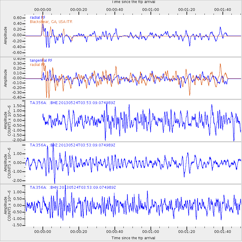
356A Blackshear, GA, USA - Earthquake Result Viewer
*The percent match for this event was below the threshold and hence no stack was calculated.
| Earthquake location: |
Northern California |
| Earthquake latitude/longitude: |
40.2/-121.1 |
| Earthquake time(UTC): |
2013/05/24 (144) 03:47:08 GMT |
| Earthquake Depth: |
9.7 km |
| Earthquake Magnitude: |
5.7 MW, 5.7 MB, 5.7 MW |
| Earthquake Catalog/Contributor: |
NEIC PDE/NEIC PDE-W |
|
| Network: |
TA USArray Transportable Network (new EarthScope stations) |
| Station: |
356A Blackshear, GA, USA |
| Lat/Lon: |
31.32 N/82.13 W |
| Elevation: |
36 m |
|
| Distance: |
32.6 deg |
| Az: |
93.366 deg |
| Baz: |
296.675 deg |
| Ray Param: |
$rayparam |
*The percent match for this event was below the threshold and hence was not used in the summary stack. |
|
| Radial Match: |
68.679596 % |
| Radial Bump: |
400 |
| Transverse Match: |
54.175953 % |
| Transverse Bump: |
400 |
| SOD ConfigId: |
512894 |
| Insert Time: |
2013-09-14 16:58:28.713 +0000 |
| GWidth: |
2.5 |
| Max Bumps: |
400 |
| Tol: |
0.001 |
|
Signal To Noise
| Channel | StoN | STA | LTA |
| TA:356A: :BHZ:20130524T03:53:09.074989Z | 2.1100934 | 7.6263655E-7 | 3.614231E-7 |
| TA:356A: :BHN:20130524T03:53:09.074989Z | 1.4577782 | 4.1174206E-7 | 2.8244494E-7 |
| TA:356A: :BHE:20130524T03:53:09.074989Z | 1.1397442 | 5.0197974E-7 | 4.4043196E-7 |
| Arrivals |
| Ps | |
| PpPs | |
| PsPs/PpSs | |


