You are here: Home > Network List > TA - USArray Transportable Network (new EarthScope stations) Stations List
> Station D51A Lot 18 Range III Mazenod Township, QC, CAN > Earthquake Result Viewer
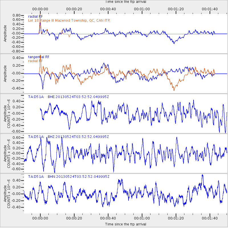
D51A Lot 18 Range III Mazenod Township, QC, CAN - Earthquake Result Viewer
*The percent match for this event was below the threshold and hence no stack was calculated.
| Earthquake location: |
Northern California |
| Earthquake latitude/longitude: |
40.2/-121.1 |
| Earthquake time(UTC): |
2013/05/24 (144) 03:47:08 GMT |
| Earthquake Depth: |
9.7 km |
| Earthquake Magnitude: |
5.7 MW, 5.7 MB, 5.7 MW |
| Earthquake Catalog/Contributor: |
NEIC PDE/NEIC PDE-W |
|
| Network: |
TA USArray Transportable Network (new EarthScope stations) |
| Station: |
D51A Lot 18 Range III Mazenod Township, QC, CAN |
| Lat/Lon: |
47.09 N/79.37 W |
| Elevation: |
282 m |
|
| Distance: |
30.7 deg |
| Az: |
63.026 deg |
| Baz: |
272.422 deg |
| Ray Param: |
$rayparam |
*The percent match for this event was below the threshold and hence was not used in the summary stack. |
|
| Radial Match: |
48.771496 % |
| Radial Bump: |
400 |
| Transverse Match: |
51.74697 % |
| Transverse Bump: |
400 |
| SOD ConfigId: |
512894 |
| Insert Time: |
2013-09-14 16:59:17.975 +0000 |
| GWidth: |
2.5 |
| Max Bumps: |
400 |
| Tol: |
0.001 |
|
Signal To Noise
| Channel | StoN | STA | LTA |
| TA:D51A: :BHZ:20130524T03:52:52.049995Z | 2.6739082 | 4.0235847E-7 | 1.504758E-7 |
| TA:D51A: :BHN:20130524T03:52:52.049995Z | 1.6678116 | 1.9842973E-7 | 1.189761E-7 |
| TA:D51A: :BHE:20130524T03:52:52.049995Z | 1.3592621 | 2.4175642E-7 | 1.7785858E-7 |
| Arrivals |
| Ps | |
| PpPs | |
| PsPs/PpSs | |


