TSK Tsukuba, Japan - Earthquake Result Viewer
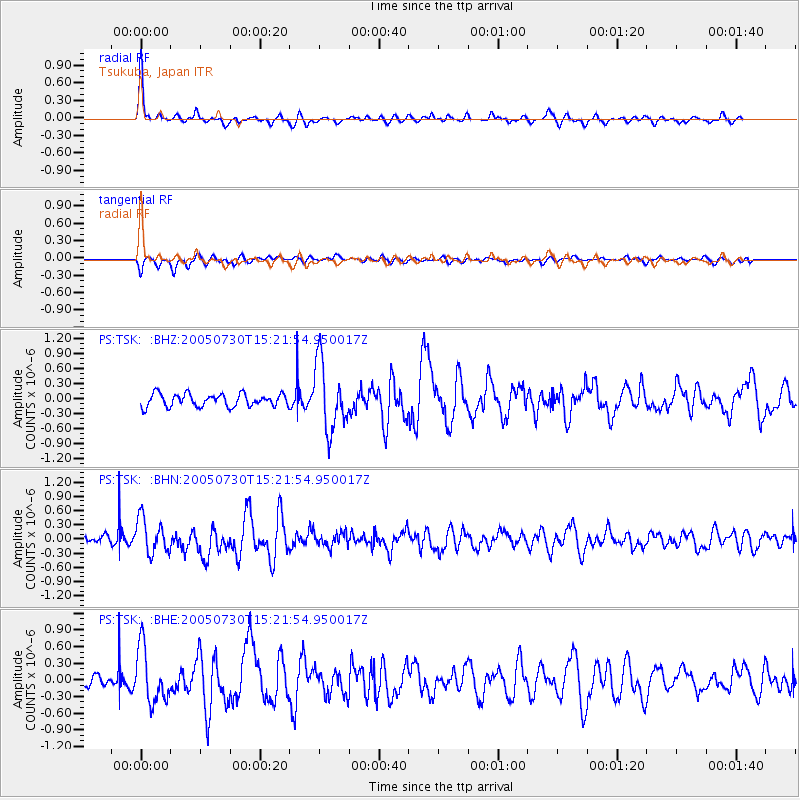
Earthquake location: Northern Sumatra, Indonesia
Earthquake latitude/longitude: 5.2/94.5
Earthquake time(UTC): 2005/07/30 (211) 15:13:20 GMT
Earthquake Depth: 38 km
Earthquake Magnitude: 5.8 MB, 5.2 MS, 5.8 MW, 5.8 MW
Earthquake Catalog/Contributor: WHDF/NEIC
Network: PS Pacific21
Station: TSK Tsukuba, Japan
Lat/Lon: 36.21 N/140.11 E
Elevation: 350 m
Distance: 52.0 deg
Az: 47.214 deg
Baz: 244.663 deg
Ray Param: 0.06697589
Estimated Moho Depth: 45.0 km
Estimated Crust Vp/Vs: 1.82
Assumed Crust Vp: 6.24 km/s
Estimated Crust Vs: 3.424 km/s
Estimated Crust Poisson's Ratio: 0.28
Radial Match: 88.82823 %
Radial Bump: 344
Transverse Match: 69.334724 %
Transverse Bump: 400
SOD ConfigId: 2564
Insert Time: 2010-02-27 03:55:19.265 +0000
GWidth: 2.5
Max Bumps: 400
Tol: 0.001

Signal To Noise

ChannelStoNSTALTA
PS:TSK: :BHN:20050730T15:21:54.950017Z4.21743973.7267378E-78.8364935E-8
PS:TSK: :BHE:20050730T15:21:54.950017Z6.2312994.979387E-77.9909285E-8
PS:TSK: :BHZ:20050730T15:21:54.950017Z5.42799956.8536315E-71.2626441E-7
Arrivals
Ps6.2 SECOND
PpPs19 SECOND
PsPs/PpSs26 SECOND