TSK Tsukuba, Japan - Earthquake Result Viewer
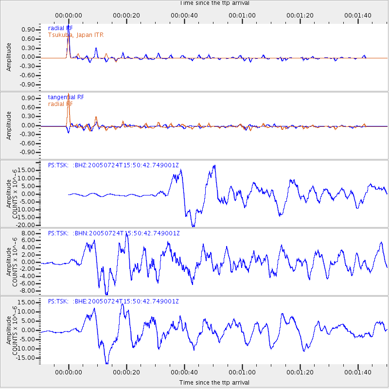
Earthquake location: Nicobar Islands, India Region
Earthquake latitude/longitude: 7.9/92.2
Earthquake time(UTC): 2005/07/24 (205) 15:42:06 GMT
Earthquake Depth: 16 km
Earthquake Magnitude: 6.6 MB, 7.5 MS, 7.3 MW, 7.2 MW
Earthquake Catalog/Contributor: WHDF/NEIC
Network: PS Pacific21
Station: TSK Tsukuba, Japan
Lat/Lon: 36.21 N/140.11 E
Elevation: 350 m
Distance: 51.9 deg
Az: 49.733 deg
Baz: 249.167 deg
Ray Param: 0.06711186
Estimated Moho Depth: 43.75 km
Estimated Crust Vp/Vs: 1.84
Assumed Crust Vp: 6.24 km/s
Estimated Crust Vs: 3.396 km/s
Estimated Crust Poisson's Ratio: 0.29
Radial Match: 97.6112 %
Radial Bump: 245
Transverse Match: 86.558754 %
Transverse Bump: 400
SOD ConfigId: 2564
Insert Time: 2010-02-27 03:55:20.286 +0000
GWidth: 2.5
Max Bumps: 400
Tol: 0.001

Signal To Noise

ChannelStoNSTALTA
PS:TSK: :BHN:20050724T15:50:42.749001Z1.92214386.0290483E-73.1366272E-7
PS:TSK: :BHE:20050724T15:50:42.749001Z2.69220078.632913E-73.2066382E-7
PS:TSK: :BHZ:20050724T15:50:42.749001Z2.2363341.2607406E-65.6375325E-7
Arrivals
Ps6.2 SECOND
PpPs19 SECOND
PsPs/PpSs25 SECOND