You are here: Home > Network List > AV - Alaska Volcano Observatory Stations List
> Station MAPS Pakushin Southeast, Makushin Volcano, Alaska > Earthquake Result Viewer
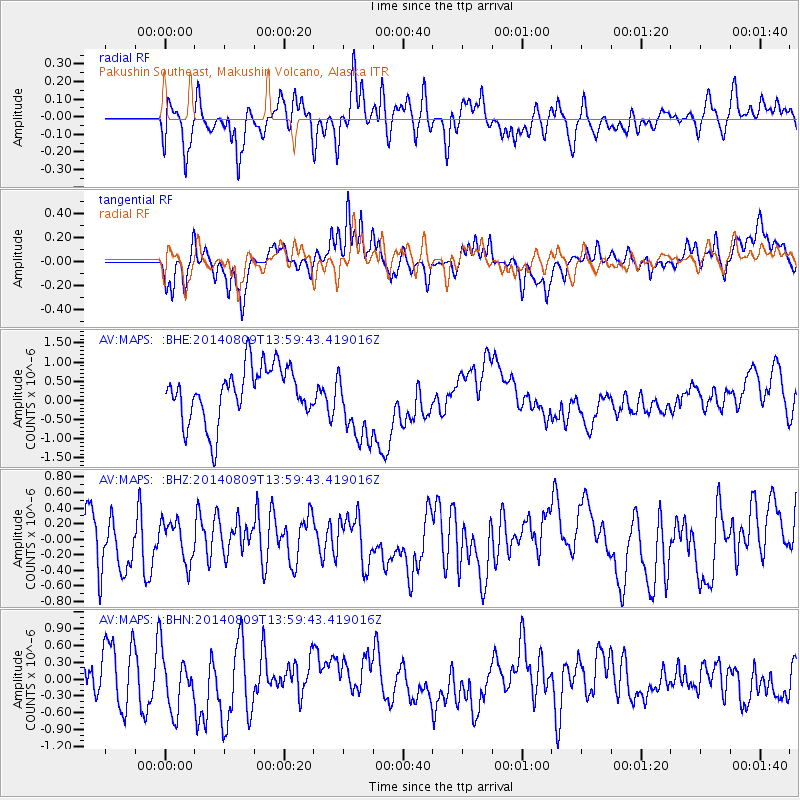
MAPS Pakushin Southeast, Makushin Volcano, Alaska - Earthquake Result Viewer
*The percent match for this event was below the threshold and hence no stack was calculated.
| Earthquake location: |
Central Italy |
| Earthquake latitude/longitude: |
43.5/11.0 |
| Earthquake time(UTC): |
2014/08/09 (221) 13:47:49 GMT |
| Earthquake Depth: |
9.9 km |
| Earthquake Magnitude: |
3.4 Mw, 3.4 ML |
| Earthquake Catalog/Contributor: |
ISC/ISC |
|
| Network: |
AV Alaska Volcano Observatory |
| Station: |
MAPS Pakushin Southeast, Makushin Volcano, Alaska |
| Lat/Lon: |
53.81 N/166.94 W |
| Elevation: |
333 m |
|
| Distance: |
83.0 deg |
| Az: |
358.791 deg |
| Baz: |
1.482 deg |
| Ray Param: |
$rayparam |
*The percent match for this event was below the threshold and hence was not used in the summary stack. |
|
| Radial Match: |
57.441063 % |
| Radial Bump: |
400 |
| Transverse Match: |
48.94215 % |
| Transverse Bump: |
400 |
| SOD ConfigId: |
3390531 |
| Insert Time: |
2019-04-13 06:32:35.969 +0000 |
| GWidth: |
2.5 |
| Max Bumps: |
400 |
| Tol: |
0.001 |
|
Signal To Noise
| Channel | StoN | STA | LTA |
| AV:MAPS: :BHZ:20140809T13:59:43.419016Z | 0.79041666 | 2.6160185E-7 | 3.3096703E-7 |
| AV:MAPS: :BHN:20140809T13:59:43.419016Z | 1.1770682 | 5.036163E-7 | 4.2785652E-7 |
| AV:MAPS: :BHE:20140809T13:59:43.419016Z | 1.4364437 | 1.0029663E-6 | 6.9822875E-7 |
| Arrivals |
| Ps | |
| PpPs | |
| PsPs/PpSs | |


