You are here: Home > Network List > GS - US Geological Survey Networks Stations List
> Station KAN10 Keim Farm > Earthquake Result Viewer
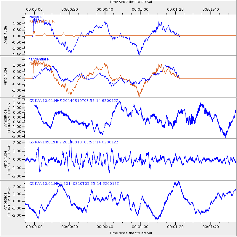
KAN10 Keim Farm - Earthquake Result Viewer
*The percent match for this event was below the threshold and hence no stack was calculated.
| Earthquake location: |
Hokkaido, Japan Region |
| Earthquake latitude/longitude: |
41.1/142.2 |
| Earthquake time(UTC): |
2014/08/10 (222) 03:43:16 GMT |
| Earthquake Depth: |
38 km |
| Earthquake Magnitude: |
6.0 MB |
| Earthquake Catalog/Contributor: |
NEIC PDE/NEIC COMCAT |
|
| Network: |
GS US Geological Survey Networks |
| Station: |
KAN10 Keim Farm |
| Lat/Lon: |
37.12 N/98.10 W |
| Elevation: |
417 m |
|
| Distance: |
84.6 deg |
| Az: |
44.199 deg |
| Baz: |
318.794 deg |
| Ray Param: |
$rayparam |
*The percent match for this event was below the threshold and hence was not used in the summary stack. |
|
| Radial Match: |
44.846558 % |
| Radial Bump: |
400 |
| Transverse Match: |
51.030388 % |
| Transverse Bump: |
400 |
| SOD ConfigId: |
3390531 |
| Insert Time: |
2019-04-13 06:44:51.931 +0000 |
| GWidth: |
2.5 |
| Max Bumps: |
400 |
| Tol: |
0.001 |
|
Signal To Noise
| Channel | StoN | STA | LTA |
| GS:KAN10:01:HHZ:20140810T03:55:14.620012Z | 6.8414516 | 8.354269E-7 | 1.2211252E-7 |
| GS:KAN10:01:HHN:20140810T03:55:14.620012Z | 1.3694229 | 1.8975959E-6 | 1.3856902E-6 |
| GS:KAN10:01:HHE:20140810T03:55:14.620012Z | 1.4846685 | 8.630625E-7 | 5.813166E-7 |
| Arrivals |
| Ps | |
| PpPs | |
| PsPs/PpSs | |


