You are here: Home > Network List > US - United States National Seismic Network Stations List
> Station AMTX Amarillo, Texas, USA > Earthquake Result Viewer
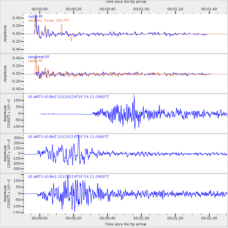
AMTX Amarillo, Texas, USA - Earthquake Result Viewer
*The percent match for this event was below the threshold and hence no stack was calculated.
| Earthquake location: |
Sea Of Okhotsk |
| Earthquake latitude/longitude: |
54.9/153.2 |
| Earthquake time(UTC): |
2013/05/24 (144) 05:44:48 GMT |
| Earthquake Depth: |
598 km |
| Earthquake Magnitude: |
8.4 MW, 7.5 MB, 8.3 MW |
| Earthquake Catalog/Contributor: |
NEIC PDE/NEIC PDE-W |
|
| Network: |
US United States National Seismic Network |
| Station: |
AMTX Amarillo, Texas, USA |
| Lat/Lon: |
34.53 N/101.41 W |
| Elevation: |
1010 m |
|
| Distance: |
70.5 deg |
| Az: |
57.631 deg |
| Baz: |
323.771 deg |
| Ray Param: |
$rayparam |
*The percent match for this event was below the threshold and hence was not used in the summary stack. |
|
| Radial Match: |
97.811905 % |
| Radial Bump: |
400 |
| Transverse Match: |
91.93714 % |
| Transverse Bump: |
400 |
| SOD ConfigId: |
512894 |
| Insert Time: |
2013-09-14 17:55:13.134 +0000 |
| GWidth: |
2.5 |
| Max Bumps: |
400 |
| Tol: |
0.001 |
|
Signal To Noise
| Channel | StoN | STA | LTA |
| US:AMTX:00:BHZ:20130524T05:54:31.04897Z | 25.026974 | 5.5808367E-5 | 2.2299287E-6 |
| US:AMTX:00:BH1:20130524T05:54:31.04897Z | 23.715866 | 2.2251621E-5 | 9.382589E-7 |
| US:AMTX:00:BH2:20130524T05:54:31.04897Z | 22.115524 | 1.5722351E-5 | 7.109192E-7 |
| Arrivals |
| Ps | |
| PpPs | |
| PsPs/PpSs | |


