You are here: Home > Network List > TA - USArray Transportable Network (new EarthScope stations) Stations List
> Station P56A Dayton Farm, Ripley, WV, USA > Earthquake Result Viewer
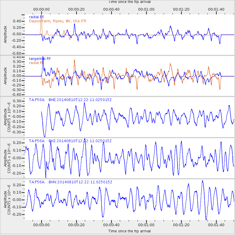
P56A Dayton Farm, Ripley, WV, USA - Earthquake Result Viewer
*The percent match for this event was below the threshold and hence no stack was calculated.
| Earthquake location: |
Central Mid-Atlantic Ridge |
| Earthquake latitude/longitude: |
0.7/-26.0 |
| Earthquake time(UTC): |
2014/08/10 (222) 12:12:24 GMT |
| Earthquake Depth: |
10 km |
| Earthquake Magnitude: |
5.1 MW, 5.0 mb |
| Earthquake Catalog/Contributor: |
ISC/ISC |
|
| Network: |
TA USArray Transportable Network (new EarthScope stations) |
| Station: |
P56A Dayton Farm, Ripley, WV, USA |
| Lat/Lon: |
39.50 N/78.84 W |
| Elevation: |
249 m |
|
| Distance: |
61.6 deg |
| Az: |
315.519 deg |
| Baz: |
115.099 deg |
| Ray Param: |
$rayparam |
*The percent match for this event was below the threshold and hence was not used in the summary stack. |
|
| Radial Match: |
48.636837 % |
| Radial Bump: |
400 |
| Transverse Match: |
58.06541 % |
| Transverse Bump: |
400 |
| SOD ConfigId: |
3390531 |
| Insert Time: |
2019-04-13 06:58:45.540 +0000 |
| GWidth: |
2.5 |
| Max Bumps: |
400 |
| Tol: |
0.001 |
|
Signal To Noise
| Channel | StoN | STA | LTA |
| TA:P56A: :BHZ:20140810T12:22:11.025015Z | 1.2247555 | 1.1697429E-7 | 9.550828E-8 |
| TA:P56A: :BHN:20140810T12:22:11.025015Z | 0.62355846 | 5.1376535E-8 | 8.239249E-8 |
| TA:P56A: :BHE:20140810T12:22:11.025015Z | 0.4866231 | 7.553111E-8 | 1.552148E-7 |
| Arrivals |
| Ps | |
| PpPs | |
| PsPs/PpSs | |


