You are here: Home > Network List > TA - USArray Transportable Network (new EarthScope stations) Stations List
> Station Q53A Leroy, WV, USA > Earthquake Result Viewer
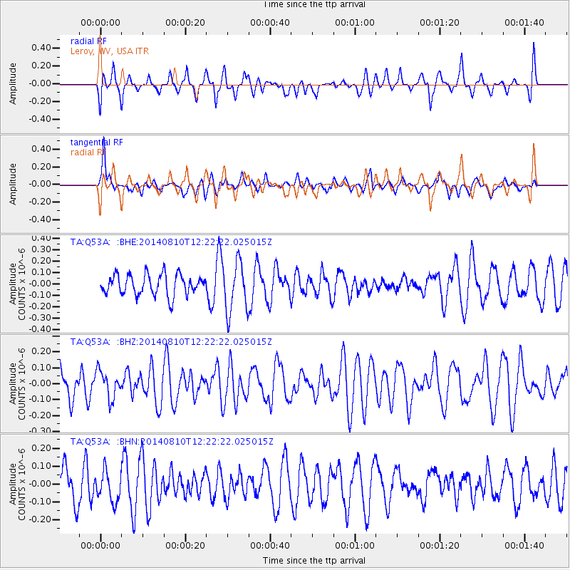
Q53A Leroy, WV, USA - Earthquake Result Viewer
*The percent match for this event was below the threshold and hence no stack was calculated.
| Earthquake location: |
Central Mid-Atlantic Ridge |
| Earthquake latitude/longitude: |
0.7/-26.0 |
| Earthquake time(UTC): |
2014/08/10 (222) 12:12:24 GMT |
| Earthquake Depth: |
10 km |
| Earthquake Magnitude: |
5.1 MW, 5.0 mb |
| Earthquake Catalog/Contributor: |
ISC/ISC |
|
| Network: |
TA USArray Transportable Network (new EarthScope stations) |
| Station: |
Q53A Leroy, WV, USA |
| Lat/Lon: |
38.86 N/81.53 W |
| Elevation: |
310 m |
|
| Distance: |
63.2 deg |
| Az: |
313.9 deg |
| Baz: |
112.659 deg |
| Ray Param: |
$rayparam |
*The percent match for this event was below the threshold and hence was not used in the summary stack. |
|
| Radial Match: |
64.85086 % |
| Radial Bump: |
400 |
| Transverse Match: |
74.956085 % |
| Transverse Bump: |
400 |
| SOD ConfigId: |
3390531 |
| Insert Time: |
2019-04-13 06:58:47.860 +0000 |
| GWidth: |
2.5 |
| Max Bumps: |
400 |
| Tol: |
0.001 |
|
Signal To Noise
| Channel | StoN | STA | LTA |
| TA:Q53A: :BHZ:20140810T12:22:22.025015Z | 0.38690928 | 8.6577124E-8 | 2.2376597E-7 |
| TA:Q53A: :BHN:20140810T12:22:22.025015Z | 0.73575544 | 8.753262E-8 | 1.1896973E-7 |
| TA:Q53A: :BHE:20140810T12:22:22.025015Z | 2.5033374 | 2.2533688E-7 | 9.001458E-8 |
| Arrivals |
| Ps | |
| PpPs | |
| PsPs/PpSs | |


