You are here: Home > Network List > TA - USArray Transportable Network (new EarthScope stations) Stations List
> Station J01E Myrtle Point, OR, USA > Earthquake Result Viewer
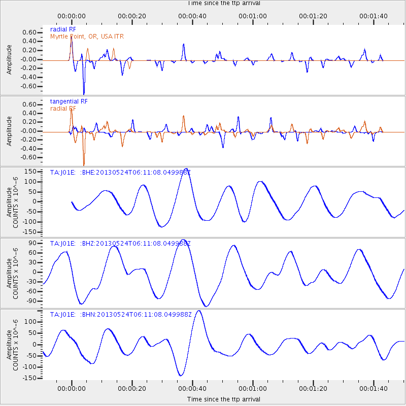
J01E Myrtle Point, OR, USA - Earthquake Result Viewer
*The percent match for this event was below the threshold and hence no stack was calculated.
| Earthquake location: |
Sea Of Okhotsk |
| Earthquake latitude/longitude: |
53.0/153.0 |
| Earthquake time(UTC): |
2013/05/24 (144) 06:03:07 GMT |
| Earthquake Depth: |
514 km |
| Earthquake Magnitude: |
5.5 MB |
| Earthquake Catalog/Contributor: |
NEIC PDE/NEIC PDE-W |
|
| Network: |
TA USArray Transportable Network (new EarthScope stations) |
| Station: |
J01E Myrtle Point, OR, USA |
| Lat/Lon: |
43.16 N/123.93 W |
| Elevation: |
128 m |
|
| Distance: |
53.4 deg |
| Az: |
64.827 deg |
| Baz: |
311.66 deg |
| Ray Param: |
$rayparam |
*The percent match for this event was below the threshold and hence was not used in the summary stack. |
|
| Radial Match: |
68.6634 % |
| Radial Bump: |
280 |
| Transverse Match: |
72.65955 % |
| Transverse Bump: |
257 |
| SOD ConfigId: |
512894 |
| Insert Time: |
2013-09-14 18:23:35.841 +0000 |
| GWidth: |
2.5 |
| Max Bumps: |
400 |
| Tol: |
0.001 |
|
Signal To Noise
| Channel | StoN | STA | LTA |
| TA:J01E: :BHZ:20130524T06:11:08.049988Z | 1.6257569 | 7.371903E-5 | 4.5344437E-5 |
| TA:J01E: :BHN:20130524T06:11:08.049988Z | 1.1663554 | 3.6010795E-5 | 3.0874635E-5 |
| TA:J01E: :BHE:20130524T06:11:08.049988Z | 2.2413561 | 9.78655E-5 | 4.366352E-5 |
| Arrivals |
| Ps | |
| PpPs | |
| PsPs/PpSs | |


