You are here: Home > Network List > TA - USArray Transportable Network (new EarthScope stations) Stations List
> Station T57A Hurt, VA, USA > Earthquake Result Viewer
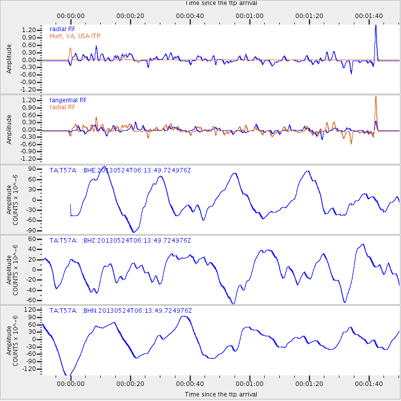
T57A Hurt, VA, USA - Earthquake Result Viewer
*The percent match for this event was below the threshold and hence no stack was calculated.
| Earthquake location: |
Sea Of Okhotsk |
| Earthquake latitude/longitude: |
53.0/153.0 |
| Earthquake time(UTC): |
2013/05/24 (144) 06:03:07 GMT |
| Earthquake Depth: |
514 km |
| Earthquake Magnitude: |
5.5 MB |
| Earthquake Catalog/Contributor: |
NEIC PDE/NEIC PDE-W |
|
| Network: |
TA USArray Transportable Network (new EarthScope stations) |
| Station: |
T57A Hurt, VA, USA |
| Lat/Lon: |
37.00 N/79.25 W |
| Elevation: |
230 m |
|
| Distance: |
79.5 deg |
| Az: |
40.068 deg |
| Baz: |
330.944 deg |
| Ray Param: |
$rayparam |
*The percent match for this event was below the threshold and hence was not used in the summary stack. |
|
| Radial Match: |
32.66685 % |
| Radial Bump: |
347 |
| Transverse Match: |
30.730576 % |
| Transverse Bump: |
355 |
| SOD ConfigId: |
512894 |
| Insert Time: |
2013-09-14 18:27:43.093 +0000 |
| GWidth: |
2.5 |
| Max Bumps: |
400 |
| Tol: |
0.001 |
|
Signal To Noise
| Channel | StoN | STA | LTA |
| TA:T57A: :BHZ:20130524T06:13:49.724976Z | 0.6379464 | 1.1918877E-5 | 1.8683195E-5 |
| TA:T57A: :BHN:20130524T06:13:49.724976Z | 2.7923412 | 1.2242408E-4 | 4.3842807E-5 |
| TA:T57A: :BHE:20130524T06:13:49.724976Z | 0.8252833 | 4.835555E-5 | 5.8592665E-5 |
| Arrivals |
| Ps | |
| PpPs | |
| PsPs/PpSs | |


