You are here: Home > Network List > TA - USArray Transportable Network (new EarthScope stations) Stations List
> Station X50B Fort Payne, AL, USA > Earthquake Result Viewer
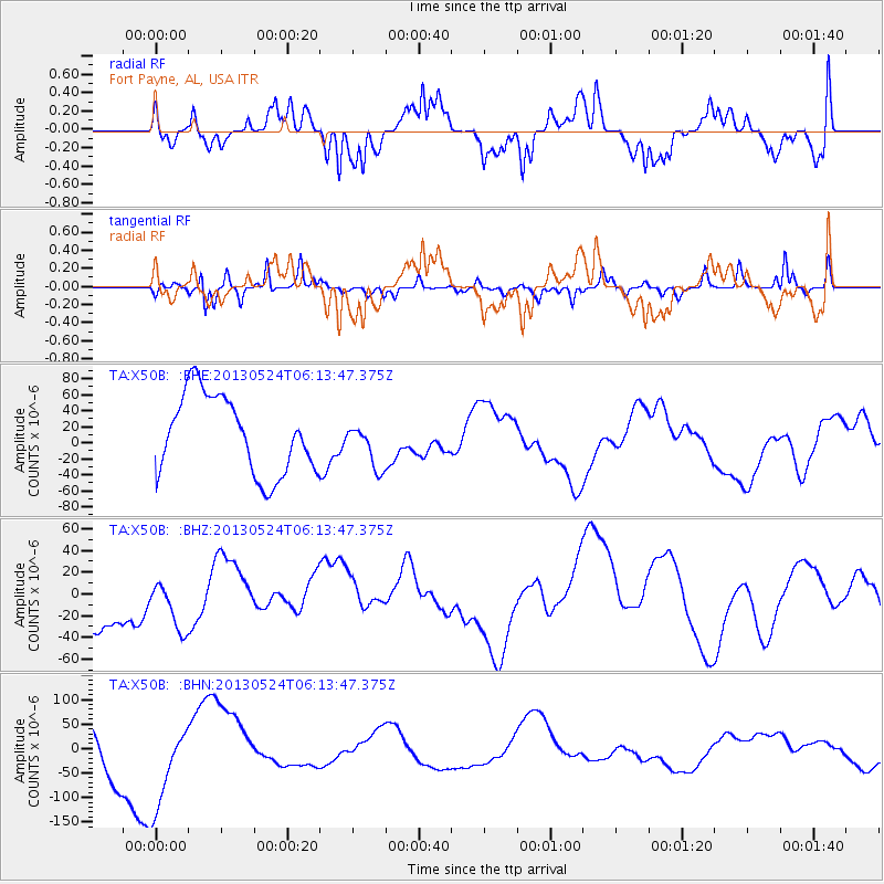
X50B Fort Payne, AL, USA - Earthquake Result Viewer
*The percent match for this event was below the threshold and hence no stack was calculated.
| Earthquake location: |
Sea Of Okhotsk |
| Earthquake latitude/longitude: |
53.0/153.0 |
| Earthquake time(UTC): |
2013/05/24 (144) 06:03:07 GMT |
| Earthquake Depth: |
514 km |
| Earthquake Magnitude: |
5.5 MB |
| Earthquake Catalog/Contributor: |
NEIC PDE/NEIC PDE-W |
|
| Network: |
TA USArray Transportable Network (new EarthScope stations) |
| Station: |
X50B Fort Payne, AL, USA |
| Lat/Lon: |
34.46 N/85.65 W |
| Elevation: |
494 m |
|
| Distance: |
79.1 deg |
| Az: |
45.938 deg |
| Baz: |
328.311 deg |
| Ray Param: |
$rayparam |
*The percent match for this event was below the threshold and hence was not used in the summary stack. |
|
| Radial Match: |
39.83859 % |
| Radial Bump: |
396 |
| Transverse Match: |
42.236412 % |
| Transverse Bump: |
286 |
| SOD ConfigId: |
512894 |
| Insert Time: |
2013-09-14 18:29:52.792 +0000 |
| GWidth: |
2.5 |
| Max Bumps: |
400 |
| Tol: |
0.001 |
|
Signal To Noise
| Channel | StoN | STA | LTA |
| TA:X50B: :BHZ:20130524T06:13:47.375Z | 1.0730978 | 2.7654234E-5 | 2.5770469E-5 |
| TA:X50B: :BHN:20130524T06:13:47.375Z | 1.5335492 | 9.7111006E-5 | 6.332435E-5 |
| TA:X50B: :BHE:20130524T06:13:47.375Z | 0.5884271 | 2.8597828E-5 | 4.860046E-5 |
| Arrivals |
| Ps | |
| PpPs | |
| PsPs/PpSs | |


