You are here: Home > Network List > BK - Berkeley Digital Seismograph Network Stations List
> Station HUMO Hull Mountain, OR > Earthquake Result Viewer
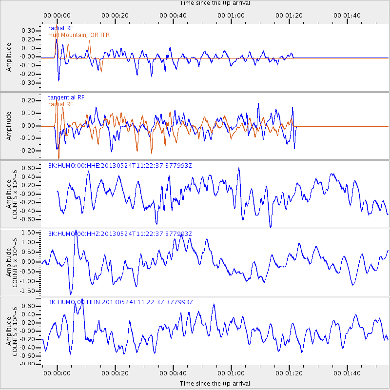
HUMO Hull Mountain, OR - Earthquake Result Viewer
*The percent match for this event was below the threshold and hence no stack was calculated.
| Earthquake location: |
South Of Tonga Islands |
| Earthquake latitude/longitude: |
-24.3/-174.9 |
| Earthquake time(UTC): |
2013/05/24 (144) 11:10:48 GMT |
| Earthquake Depth: |
10 km |
| Earthquake Magnitude: |
5.8 MB, 5.9 MS |
| Earthquake Catalog/Contributor: |
NEIC PDE/NEIC PDE-W |
|
| Network: |
BK Berkeley Digital Seismograph Network |
| Station: |
HUMO Hull Mountain, OR |
| Lat/Lon: |
42.61 N/122.96 W |
| Elevation: |
555 m |
|
| Distance: |
82.0 deg |
| Az: |
35.955 deg |
| Baz: |
226.508 deg |
| Ray Param: |
$rayparam |
*The percent match for this event was below the threshold and hence was not used in the summary stack. |
|
| Radial Match: |
67.48151 % |
| Radial Bump: |
400 |
| Transverse Match: |
77.08266 % |
| Transverse Bump: |
400 |
| SOD ConfigId: |
512894 |
| Insert Time: |
2013-09-14 18:39:27.839 +0000 |
| GWidth: |
2.5 |
| Max Bumps: |
400 |
| Tol: |
0.001 |
|
Signal To Noise
| Channel | StoN | STA | LTA |
| BK:HUMO:00:HHZ:20130524T11:22:37.377993Z | 2.3239195 | 6.026827E-7 | 2.5933886E-7 |
| BK:HUMO:00:HHN:20130524T11:22:37.377993Z | 0.4821373 | 2.7818484E-7 | 5.7698264E-7 |
| BK:HUMO:00:HHE:20130524T11:22:37.377993Z | 1.5827082 | 3.6849292E-7 | 2.3282428E-7 |
| Arrivals |
| Ps | |
| PpPs | |
| PsPs/PpSs | |


