You are here: Home > Network List > US - United States National Seismic Network Stations List
> Station AMTX Amarillo, Texas, USA > Earthquake Result Viewer
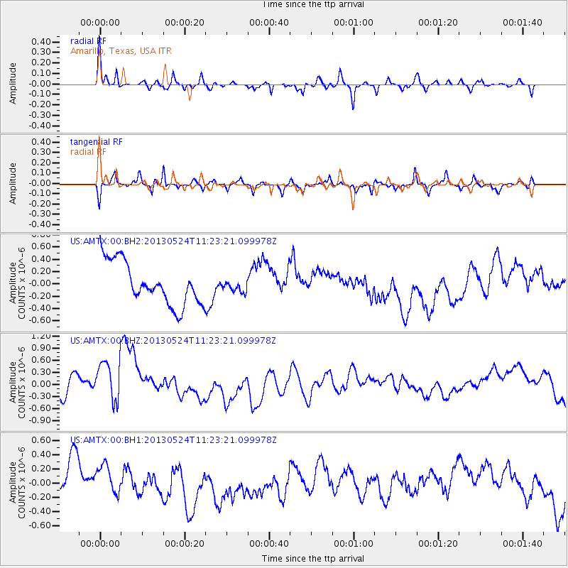
AMTX Amarillo, Texas, USA - Earthquake Result Viewer
*The percent match for this event was below the threshold and hence no stack was calculated.
| Earthquake location: |
South Of Tonga Islands |
| Earthquake latitude/longitude: |
-24.3/-174.9 |
| Earthquake time(UTC): |
2013/05/24 (144) 11:10:48 GMT |
| Earthquake Depth: |
10 km |
| Earthquake Magnitude: |
5.8 MB, 5.9 MS |
| Earthquake Catalog/Contributor: |
NEIC PDE/NEIC PDE-W |
|
| Network: |
US United States National Seismic Network |
| Station: |
AMTX Amarillo, Texas, USA |
| Lat/Lon: |
34.53 N/101.41 W |
| Elevation: |
1010 m |
|
| Distance: |
91.0 deg |
| Az: |
52.352 deg |
| Baz: |
241.023 deg |
| Ray Param: |
$rayparam |
*The percent match for this event was below the threshold and hence was not used in the summary stack. |
|
| Radial Match: |
71.462326 % |
| Radial Bump: |
256 |
| Transverse Match: |
53.690052 % |
| Transverse Bump: |
267 |
| SOD ConfigId: |
512894 |
| Insert Time: |
2013-09-14 18:50:25.569 +0000 |
| GWidth: |
2.5 |
| Max Bumps: |
400 |
| Tol: |
0.001 |
|
Signal To Noise
| Channel | StoN | STA | LTA |
| US:AMTX:00:BHZ:20130524T11:23:21.099978Z | 2.7619383 | 7.337168E-7 | 2.6565286E-7 |
| US:AMTX:00:BH1:20130524T11:23:21.099978Z | 0.7511807 | 2.1927043E-7 | 2.9190105E-7 |
| US:AMTX:00:BH2:20130524T11:23:21.099978Z | 0.25799638 | 8.736277E-8 | 3.3862014E-7 |
| Arrivals |
| Ps | |
| PpPs | |
| PsPs/PpSs | |


