You are here: Home > Network List > US - United States National Seismic Network Stations List
> Station BOZ Bozeman, Montana, USA > Earthquake Result Viewer
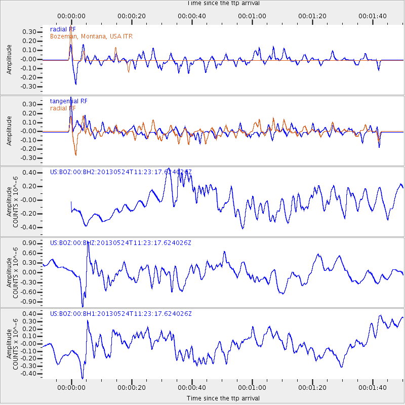
BOZ Bozeman, Montana, USA - Earthquake Result Viewer
*The percent match for this event was below the threshold and hence no stack was calculated.
| Earthquake location: |
South Of Tonga Islands |
| Earthquake latitude/longitude: |
-24.3/-174.9 |
| Earthquake time(UTC): |
2013/05/24 (144) 11:10:48 GMT |
| Earthquake Depth: |
10 km |
| Earthquake Magnitude: |
5.8 MB, 5.9 MS |
| Earthquake Catalog/Contributor: |
NEIC PDE/NEIC PDE-W |
|
| Network: |
US United States National Seismic Network |
| Station: |
BOZ Bozeman, Montana, USA |
| Lat/Lon: |
45.65 N/111.63 W |
| Elevation: |
1589 m |
|
| Distance: |
90.3 deg |
| Az: |
38.803 deg |
| Baz: |
234.575 deg |
| Ray Param: |
$rayparam |
*The percent match for this event was below the threshold and hence was not used in the summary stack. |
|
| Radial Match: |
60.635002 % |
| Radial Bump: |
400 |
| Transverse Match: |
51.691624 % |
| Transverse Bump: |
400 |
| SOD ConfigId: |
512894 |
| Insert Time: |
2013-09-14 18:50:30.912 +0000 |
| GWidth: |
2.5 |
| Max Bumps: |
400 |
| Tol: |
0.001 |
|
Signal To Noise
| Channel | StoN | STA | LTA |
| US:BOZ:00:BHZ:20130524T11:23:17.624026Z | 0.84550345 | 3.5860768E-7 | 4.2413507E-7 |
| US:BOZ:00:BH1:20130524T11:23:17.624026Z | 1.7380435 | 4.255352E-7 | 2.4483575E-7 |
| US:BOZ:00:BH2:20130524T11:23:17.624026Z | 4.243165 | 3.879857E-7 | 9.1437805E-8 |
| Arrivals |
| Ps | |
| PpPs | |
| PsPs/PpSs | |


