You are here: Home > Network List > TA - USArray Transportable Network (new EarthScope stations) Stations List
> Station V60A Jim Taylor Road, Stokes, NC, USA > Earthquake Result Viewer
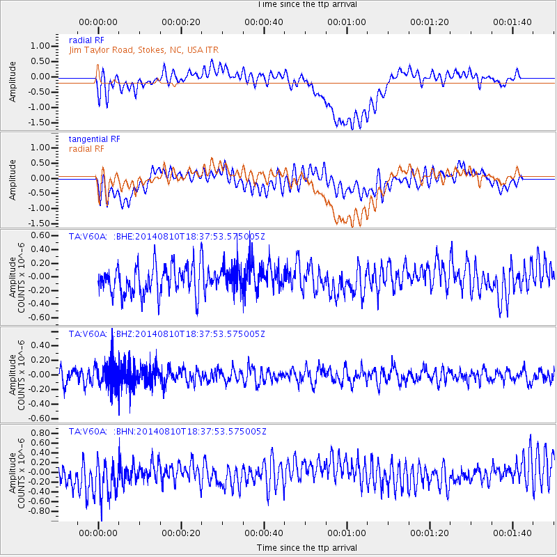
V60A Jim Taylor Road, Stokes, NC, USA - Earthquake Result Viewer
*The percent match for this event was below the threshold and hence no stack was calculated.
| Earthquake location: |
Andreanof Islands, Aleutian Is. |
| Earthquake latitude/longitude: |
51.2/-172.8 |
| Earthquake time(UTC): |
2014/08/10 (222) 18:27:38 GMT |
| Earthquake Depth: |
22 km |
| Earthquake Magnitude: |
5.0 MW, 4.4 ML, 5.0 mb |
| Earthquake Catalog/Contributor: |
ISC/ISC |
|
| Network: |
TA USArray Transportable Network (new EarthScope stations) |
| Station: |
V60A Jim Taylor Road, Stokes, NC, USA |
| Lat/Lon: |
35.76 N/77.26 W |
| Elevation: |
8.0 m |
|
| Distance: |
66.2 deg |
| Az: |
62.211 deg |
| Baz: |
316.802 deg |
| Ray Param: |
$rayparam |
*The percent match for this event was below the threshold and hence was not used in the summary stack. |
|
| Radial Match: |
42.94903 % |
| Radial Bump: |
400 |
| Transverse Match: |
46.35831 % |
| Transverse Bump: |
400 |
| SOD ConfigId: |
3390531 |
| Insert Time: |
2019-04-13 07:15:41.898 +0000 |
| GWidth: |
2.5 |
| Max Bumps: |
400 |
| Tol: |
0.001 |
|
Signal To Noise
| Channel | StoN | STA | LTA |
| TA:V60A: :BHZ:20140810T18:37:53.575005Z | 2.064833 | 1.880719E-7 | 9.108334E-8 |
| TA:V60A: :BHN:20140810T18:37:53.575005Z | 1.5110214 | 5.1902776E-7 | 3.4349466E-7 |
| TA:V60A: :BHE:20140810T18:37:53.575005Z | 0.89372635 | 1.8849569E-7 | 2.1090985E-7 |
| Arrivals |
| Ps | |
| PpPs | |
| PsPs/PpSs | |


