You are here: Home > Network List > US - United States National Seismic Network Stations List
> Station GLMI Grayling, Michigan, USA > Earthquake Result Viewer
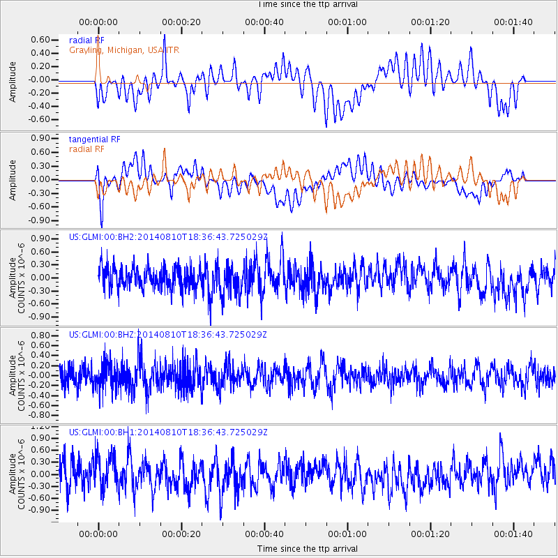
GLMI Grayling, Michigan, USA - Earthquake Result Viewer
*The percent match for this event was below the threshold and hence no stack was calculated.
| Earthquake location: |
Andreanof Islands, Aleutian Is. |
| Earthquake latitude/longitude: |
51.2/-172.8 |
| Earthquake time(UTC): |
2014/08/10 (222) 18:27:38 GMT |
| Earthquake Depth: |
22 km |
| Earthquake Magnitude: |
5.0 MW, 4.4 ML, 5.0 mb |
| Earthquake Catalog/Contributor: |
ISC/ISC |
|
| Network: |
US United States National Seismic Network |
| Station: |
GLMI Grayling, Michigan, USA |
| Lat/Lon: |
44.82 N/84.62 W |
| Elevation: |
387 m |
|
| Distance: |
55.9 deg |
| Az: |
59.194 deg |
| Baz: |
310.579 deg |
| Ray Param: |
$rayparam |
*The percent match for this event was below the threshold and hence was not used in the summary stack. |
|
| Radial Match: |
50.45961 % |
| Radial Bump: |
400 |
| Transverse Match: |
53.458324 % |
| Transverse Bump: |
400 |
| SOD ConfigId: |
3390531 |
| Insert Time: |
2019-04-13 07:16:26.616 +0000 |
| GWidth: |
2.5 |
| Max Bumps: |
400 |
| Tol: |
0.001 |
|
Signal To Noise
| Channel | StoN | STA | LTA |
| US:GLMI:00:BHZ:20140810T18:36:43.725029Z | 1.288824 | 2.657416E-7 | 2.0618921E-7 |
| US:GLMI:00:BH1:20140810T18:36:43.725029Z | 1.2041508 | 4.449909E-7 | 3.6954748E-7 |
| US:GLMI:00:BH2:20140810T18:36:43.725029Z | 1.3454545 | 3.2138848E-7 | 2.3886983E-7 |
| Arrivals |
| Ps | |
| PpPs | |
| PsPs/PpSs | |


