You are here: Home > Network List > PS - Pacific21 Stations List
> Station TSK Tsukuba, Japan > Earthquake Result Viewer
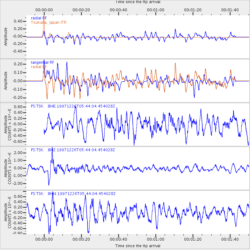
TSK Tsukuba, Japan - Earthquake Result Viewer
*The percent match for this event was below the threshold and hence no stack was calculated.
| Earthquake location: |
South Of Fiji Islands |
| Earthquake latitude/longitude: |
-22.3/-179.7 |
| Earthquake time(UTC): |
1997/12/26 (360) 05:34:24 GMT |
| Earthquake Depth: |
588 km |
| Earthquake Magnitude: |
5.9 UNKNOWN, 5.3 MB, 5.8 MW |
| Earthquake Catalog/Contributor: |
WHDF/NEIC |
|
| Network: |
PS Pacific21 |
| Station: |
TSK Tsukuba, Japan |
| Lat/Lon: |
36.21 N/140.11 E |
| Elevation: |
350 m |
|
| Distance: |
69.5 deg |
| Az: |
326.139 deg |
| Baz: |
140.368 deg |
| Ray Param: |
$rayparam |
*The percent match for this event was below the threshold and hence was not used in the summary stack. |
|
| Radial Match: |
61.116814 % |
| Radial Bump: |
400 |
| Transverse Match: |
53.99006 % |
| Transverse Bump: |
400 |
| SOD ConfigId: |
4480 |
| Insert Time: |
2010-02-27 04:04:03.970 +0000 |
| GWidth: |
2.5 |
| Max Bumps: |
400 |
| Tol: |
0.001 |
|
Signal To Noise
| Channel | StoN | STA | LTA |
| PS:TSK: :BHZ:19971226T05:44:04.454028Z | 3.6919384 | 1.0534276E-6 | 2.8533185E-7 |
| PS:TSK: :BHN:19971226T05:44:04.454028Z | 2.1690683 | 3.91689E-7 | 1.8057936E-7 |
| PS:TSK: :BHE:19971226T05:44:04.454028Z | 1.3236268 | 3.153724E-7 | 2.3826384E-7 |
| Arrivals |
| Ps | |
| PpPs | |
| PsPs/PpSs | |


