You are here: Home > Network List > CN - Canadian National Seismograph Network Stations List
> Station INK INUVIK, NT > Earthquake Result Viewer
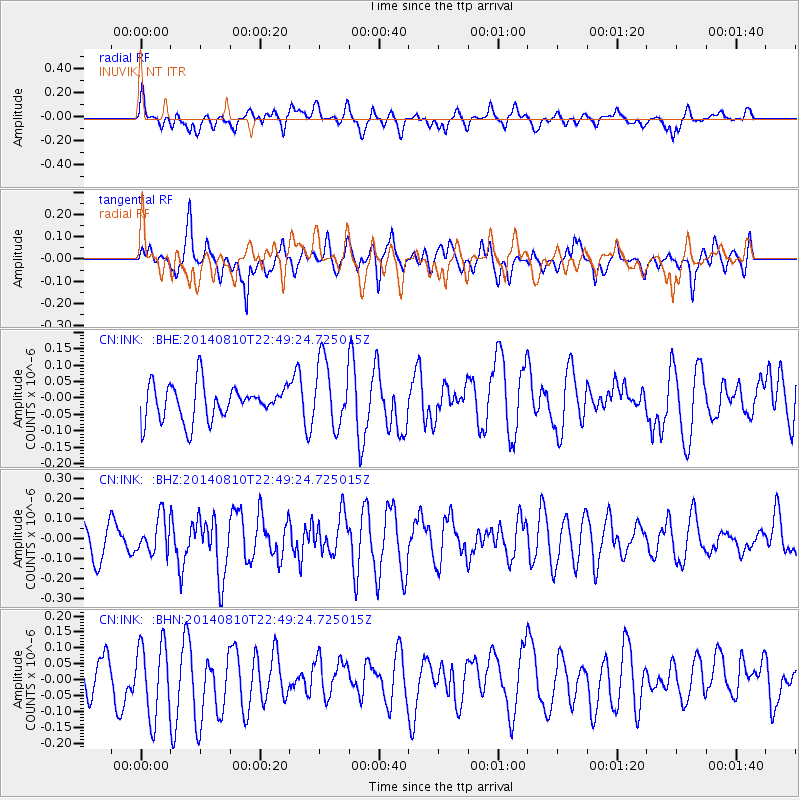
INK INUVIK, NT - Earthquake Result Viewer
*The percent match for this event was below the threshold and hence no stack was calculated.
| Earthquake location: |
Bonin Islands, Japan Region |
| Earthquake latitude/longitude: |
27.8/142.8 |
| Earthquake time(UTC): |
2014/08/10 (222) 22:39:37 GMT |
| Earthquake Depth: |
31 km |
| Earthquake Magnitude: |
5.1 MW, 5.1 mb |
| Earthquake Catalog/Contributor: |
ISC/ISC |
|
| Network: |
CN Canadian National Seismograph Network |
| Station: |
INK INUVIK, NT |
| Lat/Lon: |
68.31 N/133.53 W |
| Elevation: |
44 m |
|
| Distance: |
62.1 deg |
| Az: |
24.707 deg |
| Baz: |
275.309 deg |
| Ray Param: |
$rayparam |
*The percent match for this event was below the threshold and hence was not used in the summary stack. |
|
| Radial Match: |
53.133358 % |
| Radial Bump: |
400 |
| Transverse Match: |
43.090206 % |
| Transverse Bump: |
363 |
| SOD ConfigId: |
3390531 |
| Insert Time: |
2019-04-13 07:26:45.637 +0000 |
| GWidth: |
2.5 |
| Max Bumps: |
400 |
| Tol: |
0.001 |
|
Signal To Noise
| Channel | StoN | STA | LTA |
| CN:INK: :BHZ:20140810T22:49:24.725015Z | 0.96241707 | 8.885019E-8 | 9.2319844E-8 |
| CN:INK: :BHN:20140810T22:49:24.725015Z | 1.4294249 | 1.1622236E-7 | 8.130708E-8 |
| CN:INK: :BHE:20140810T22:49:24.725015Z | 1.867858 | 1.00655086E-7 | 5.3887977E-8 |
| Arrivals |
| Ps | |
| PpPs | |
| PsPs/PpSs | |


