You are here: Home > Network List > TA - USArray Transportable Network (new EarthScope stations) Stations List
> Station J01E Myrtle Point, OR, USA > Earthquake Result Viewer
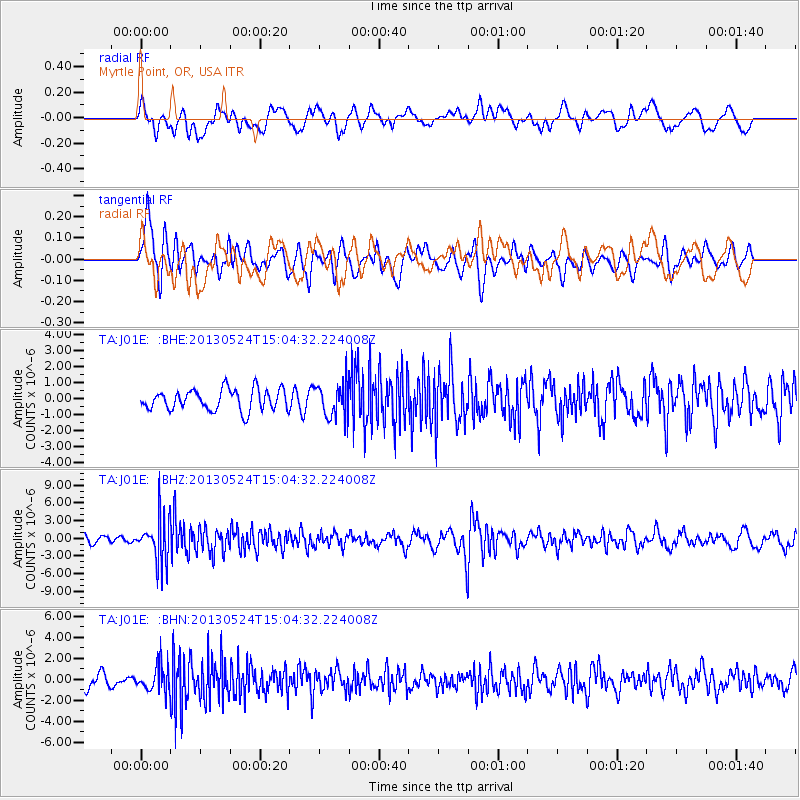
J01E Myrtle Point, OR, USA - Earthquake Result Viewer
*The percent match for this event was below the threshold and hence no stack was calculated.
| Earthquake location: |
Sea Of Okhotsk |
| Earthquake latitude/longitude: |
52.2/151.4 |
| Earthquake time(UTC): |
2013/05/24 (144) 14:56:31 GMT |
| Earthquake Depth: |
624 km |
| Earthquake Magnitude: |
6.7 MW, 6.7 MB, 6.7 MW |
| Earthquake Catalog/Contributor: |
NEIC PDE/NEIC PDE-W |
|
| Network: |
TA USArray Transportable Network (new EarthScope stations) |
| Station: |
J01E Myrtle Point, OR, USA |
| Lat/Lon: |
43.16 N/123.93 W |
| Elevation: |
128 m |
|
| Distance: |
54.6 deg |
| Az: |
63.379 deg |
| Baz: |
311.29 deg |
| Ray Param: |
$rayparam |
*The percent match for this event was below the threshold and hence was not used in the summary stack. |
|
| Radial Match: |
50.898254 % |
| Radial Bump: |
400 |
| Transverse Match: |
55.80661 % |
| Transverse Bump: |
400 |
| SOD ConfigId: |
512894 |
| Insert Time: |
2013-09-14 19:30:15.003 +0000 |
| GWidth: |
2.5 |
| Max Bumps: |
400 |
| Tol: |
0.001 |
|
Signal To Noise
| Channel | StoN | STA | LTA |
| TA:J01E: :BHZ:20130524T15:04:32.224008Z | 4.7433066 | 3.7363652E-6 | 7.877132E-7 |
| TA:J01E: :BHN:20130524T15:04:32.224008Z | 2.0086467 | 1.2148515E-6 | 6.048109E-7 |
| TA:J01E: :BHE:20130524T15:04:32.224008Z | 1.6102495 | 1.0444902E-6 | 6.4865117E-7 |
| Arrivals |
| Ps | |
| PpPs | |
| PsPs/PpSs | |


