You are here: Home > Network List > US - United States National Seismic Network Stations List
> Station MIAR Mount Ida, Arkansas, USA > Earthquake Result Viewer
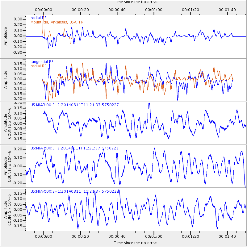
MIAR Mount Ida, Arkansas, USA - Earthquake Result Viewer
*The percent match for this event was below the threshold and hence no stack was calculated.
| Earthquake location: |
Tonga Islands Region |
| Earthquake latitude/longitude: |
-17.7/-172.8 |
| Earthquake time(UTC): |
2014/08/11 (223) 11:09:08 GMT |
| Earthquake Depth: |
50 km |
| Earthquake Magnitude: |
5.2 MW, 5.0 mb |
| Earthquake Catalog/Contributor: |
ISC/ISC |
|
| Network: |
US United States National Seismic Network |
| Station: |
MIAR Mount Ida, Arkansas, USA |
| Lat/Lon: |
34.55 N/93.58 W |
| Elevation: |
207 m |
|
| Distance: |
91.4 deg |
| Az: |
54.218 deg |
| Baz: |
249.513 deg |
| Ray Param: |
$rayparam |
*The percent match for this event was below the threshold and hence was not used in the summary stack. |
|
| Radial Match: |
66.61652 % |
| Radial Bump: |
400 |
| Transverse Match: |
49.99482 % |
| Transverse Bump: |
400 |
| SOD ConfigId: |
3390531 |
| Insert Time: |
2019-04-13 07:44:53.821 +0000 |
| GWidth: |
2.5 |
| Max Bumps: |
400 |
| Tol: |
0.001 |
|
Signal To Noise
| Channel | StoN | STA | LTA |
| US:MIAR:00:BHZ:20140811T11:21:37.575022Z | 1.1990892 | 1.09917686E-7 | 9.166765E-8 |
| US:MIAR:00:BH1:20140811T11:21:37.575022Z | 1.3409064 | 6.7356424E-8 | 5.023201E-8 |
| US:MIAR:00:BH2:20140811T11:21:37.575022Z | 1.2410157 | 7.4300445E-8 | 5.987067E-8 |
| Arrivals |
| Ps | |
| PpPs | |
| PsPs/PpSs | |


