You are here: Home > Network List > TA - USArray Transportable Network (new EarthScope stations) Stations List
> Station U46A Springville, TN, USA > Earthquake Result Viewer
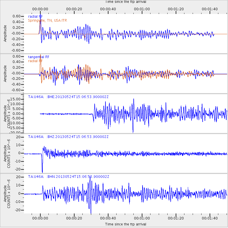
U46A Springville, TN, USA - Earthquake Result Viewer
*The percent match for this event was below the threshold and hence no stack was calculated.
| Earthquake location: |
Sea Of Okhotsk |
| Earthquake latitude/longitude: |
52.2/151.4 |
| Earthquake time(UTC): |
2013/05/24 (144) 14:56:31 GMT |
| Earthquake Depth: |
624 km |
| Earthquake Magnitude: |
6.7 MW, 6.7 MB, 6.7 MW |
| Earthquake Catalog/Contributor: |
NEIC PDE/NEIC PDE-W |
|
| Network: |
TA USArray Transportable Network (new EarthScope stations) |
| Station: |
U46A Springville, TN, USA |
| Lat/Lon: |
36.36 N/88.18 W |
| Elevation: |
146 m |
|
| Distance: |
77.6 deg |
| Az: |
45.476 deg |
| Baz: |
327.099 deg |
| Ray Param: |
$rayparam |
*The percent match for this event was below the threshold and hence was not used in the summary stack. |
|
| Radial Match: |
79.169365 % |
| Radial Bump: |
400 |
| Transverse Match: |
72.6097 % |
| Transverse Bump: |
400 |
| SOD ConfigId: |
512894 |
| Insert Time: |
2013-09-14 19:39:03.623 +0000 |
| GWidth: |
2.5 |
| Max Bumps: |
400 |
| Tol: |
0.001 |
|
Signal To Noise
| Channel | StoN | STA | LTA |
| TA:U46A: :BHZ:20130524T15:06:53.900002Z | 49.588535 | 6.533883E-6 | 1.3176198E-7 |
| TA:U46A: :BHN:20130524T15:06:53.900002Z | 19.794146 | 3.7647978E-6 | 1.9019755E-7 |
| TA:U46A: :BHE:20130524T15:06:53.900002Z | 17.74768 | 3.6361178E-6 | 2.0487848E-7 |
| Arrivals |
| Ps | |
| PpPs | |
| PsPs/PpSs | |


