You are here: Home > Network List > US - United States National Seismic Network Stations List
> Station HAWA Hanford, Washington, USA > Earthquake Result Viewer
HAWA Hanford, Washington, USA - Earthquake Result Viewer
*The percent match for this event was below the threshold and hence no stack was calculated.
| Earthquake location: |
Sea Of Okhotsk |
| Earthquake latitude/longitude: |
52.2/151.4 |
| Earthquake time(UTC): |
2013/05/24 (144) 14:56:31 GMT |
| Earthquake Depth: |
624 km |
| Earthquake Magnitude: |
6.7 MW, 6.7 MB, 6.7 MW |
| Earthquake Catalog/Contributor: |
NEIC PDE/NEIC PDE-W |
|
| Network: |
US United States National Seismic Network |
| Station: |
HAWA Hanford, Washington, USA |
| Lat/Lon: |
46.39 N/119.53 W |
| Elevation: |
364 m |
|
| Distance: |
54.8 deg |
| Az: |
57.873 deg |
| Baz: |
311.195 deg |
| Ray Param: |
$rayparam |
*The percent match for this event was below the threshold and hence was not used in the summary stack. |
|
| Radial Match: |
77.08274 % |
| Radial Bump: |
400 |
| Transverse Match: |
58.521988 % |
| Transverse Bump: |
400 |
| SOD ConfigId: |
512894 |
| Insert Time: |
2013-09-14 19:45:01.473 +0000 |
| GWidth: |
2.5 |
| Max Bumps: |
400 |
| Tol: |
0.001 |
|
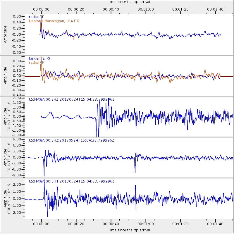
Signal To Noise
| Channel | StoN | STA | LTA |
| US:HAWA:00:BHZ:20130524T15:04:33.799996Z | 12.302561 | 2.4562632E-6 | 1.9965462E-7 |
| US:HAWA:00:BH1:20130524T15:04:33.799996Z | 8.081405 | 9.1494985E-7 | 1.1321669E-7 |
| US:HAWA:00:BH2:20130524T15:04:33.799996Z | 5.667366 | 9.044392E-7 | 1.5958723E-7 |
| Arrivals |
| Ps | |
| PpPs | |
| PsPs/PpSs | |


