You are here: Home > Network List > TA - USArray Transportable Network (new EarthScope stations) Stations List
> Station G59A Clarenceville, QC, USA > Earthquake Result Viewer
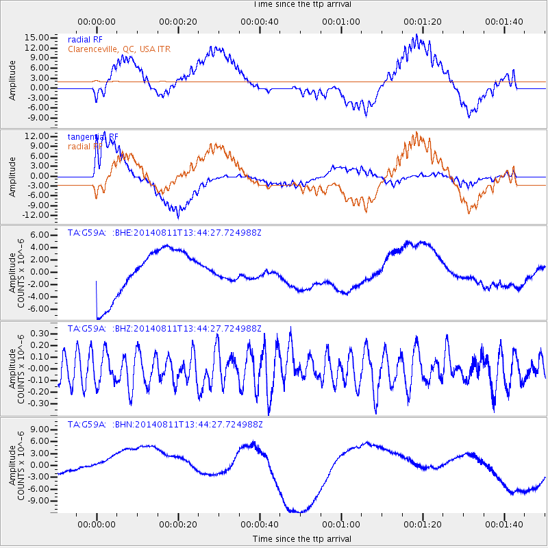
G59A Clarenceville, QC, USA - Earthquake Result Viewer
*The percent match for this event was below the threshold and hence no stack was calculated.
| Earthquake location: |
West Chile Rise |
| Earthquake latitude/longitude: |
-41.1/-85.9 |
| Earthquake time(UTC): |
2014/08/11 (223) 13:32:14 GMT |
| Earthquake Depth: |
0.0 km |
| Earthquake Magnitude: |
5.6 MW, 4.1 mb, 4.3 mb1, 4.3 mb1mx, 4.1 mbtmp, 4.0 ML, 4.8 MS, 4.8 Ms1, 4.8 ms1mx |
| Earthquake Catalog/Contributor: |
ISC/ISC |
|
| Network: |
TA USArray Transportable Network (new EarthScope stations) |
| Station: |
G59A Clarenceville, QC, USA |
| Lat/Lon: |
45.08 N/73.18 W |
| Elevation: |
36 m |
|
| Distance: |
86.6 deg |
| Az: |
9.008 deg |
| Baz: |
189.613 deg |
| Ray Param: |
$rayparam |
*The percent match for this event was below the threshold and hence was not used in the summary stack. |
|
| Radial Match: |
45.78655 % |
| Radial Bump: |
400 |
| Transverse Match: |
60.765274 % |
| Transverse Bump: |
400 |
| SOD ConfigId: |
3390531 |
| Insert Time: |
2019-04-13 07:51:17.254 +0000 |
| GWidth: |
2.5 |
| Max Bumps: |
400 |
| Tol: |
0.001 |
|
Signal To Noise
| Channel | StoN | STA | LTA |
| TA:G59A: :BHZ:20140811T13:44:27.724988Z | 0.9587469 | 1.2847423E-7 | 1.3400224E-7 |
| TA:G59A: :BHN:20140811T13:44:27.724988Z | 1.6011772 | 6.7908213E-6 | 4.241143E-6 |
| TA:G59A: :BHE:20140811T13:44:27.724988Z | 0.3011573 | 1.1622865E-6 | 3.8594E-6 |
| Arrivals |
| Ps | |
| PpPs | |
| PsPs/PpSs | |


