You are here: Home > Network List > II - Global Seismograph Network (GSN - IRIS/IDA) Stations List
> Station TAU Hobart, Tasmania, Australia > Earthquake Result Viewer
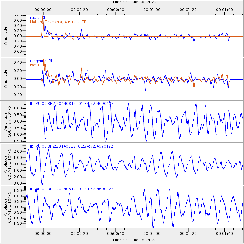
TAU Hobart, Tasmania, Australia - Earthquake Result Viewer
*The percent match for this event was below the threshold and hence no stack was calculated.
| Earthquake location: |
New Ireland Region, P.N.G. |
| Earthquake latitude/longitude: |
-3.7/151.3 |
| Earthquake time(UTC): |
2014/08/12 (224) 01:28:31 GMT |
| Earthquake Depth: |
399 km |
| Earthquake Magnitude: |
5.2 MW, 5.1 mb |
| Earthquake Catalog/Contributor: |
ISC/ISC |
|
| Network: |
II Global Seismograph Network (GSN - IRIS/IDA) |
| Station: |
TAU Hobart, Tasmania, Australia |
| Lat/Lon: |
42.91 S/147.32 E |
| Elevation: |
132 m |
|
| Distance: |
39.2 deg |
| Az: |
184.588 deg |
| Baz: |
6.237 deg |
| Ray Param: |
$rayparam |
*The percent match for this event was below the threshold and hence was not used in the summary stack. |
|
| Radial Match: |
74.14744 % |
| Radial Bump: |
400 |
| Transverse Match: |
56.222965 % |
| Transverse Bump: |
400 |
| SOD ConfigId: |
3390531 |
| Insert Time: |
2019-04-13 08:08:32.923 +0000 |
| GWidth: |
2.5 |
| Max Bumps: |
400 |
| Tol: |
0.001 |
|
Signal To Noise
| Channel | StoN | STA | LTA |
| II:TAU:00:BHZ:20140812T01:34:52.469012Z | 1.7685194 | 1.7588171E-6 | 9.945138E-7 |
| II:TAU:00:BH1:20140812T01:34:52.469012Z | 1.0282826 | 6.005473E-7 | 5.840294E-7 |
| II:TAU:00:BH2:20140812T01:34:52.469012Z | 1.6397865 | 8.550339E-7 | 5.2143E-7 |
| Arrivals |
| Ps | |
| PpPs | |
| PsPs/PpSs | |


