You are here: Home > Network List > UW - Pacific Northwest Regional Seismic Network Stations List
> Station MRBL Marblemount, WA, USA > Earthquake Result Viewer
MRBL Marblemount, WA, USA - Earthquake Result Viewer
*The percent match for this event was below the threshold and hence no stack was calculated.
| Earthquake location: |
New Ireland Region, P.N.G. |
| Earthquake latitude/longitude: |
-3.7/151.3 |
| Earthquake time(UTC): |
2014/08/12 (224) 01:28:31 GMT |
| Earthquake Depth: |
399 km |
| Earthquake Magnitude: |
5.2 MW, 5.1 mb |
| Earthquake Catalog/Contributor: |
ISC/ISC |
|
| Network: |
UW Pacific Northwest Regional Seismic Network |
| Station: |
MRBL Marblemount, WA, USA |
| Lat/Lon: |
48.52 N/121.48 W |
| Elevation: |
75 m |
|
| Distance: |
90.9 deg |
| Az: |
41.62 deg |
| Baz: |
265.518 deg |
| Ray Param: |
$rayparam |
*The percent match for this event was below the threshold and hence was not used in the summary stack. |
|
| Radial Match: |
48.5284 % |
| Radial Bump: |
400 |
| Transverse Match: |
51.004063 % |
| Transverse Bump: |
400 |
| SOD ConfigId: |
3390531 |
| Insert Time: |
2019-04-13 08:10:49.400 +0000 |
| GWidth: |
2.5 |
| Max Bumps: |
400 |
| Tol: |
0.001 |
|
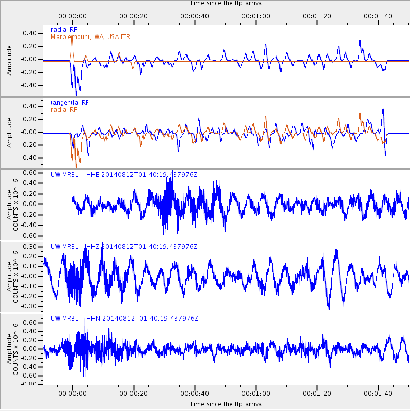
Signal To Noise
| Channel | StoN | STA | LTA |
| UW:MRBL: :HHZ:20140812T01:40:19.437976Z | 1.2647594 | 1.5291839E-7 | 1.2090709E-7 |
| UW:MRBL: :HHN:20140812T01:40:19.437976Z | 3.3070104 | 2.6070336E-7 | 7.8833544E-8 |
| UW:MRBL: :HHE:20140812T01:40:19.437976Z | 2.224347 | 2.4168006E-7 | 1.0865213E-7 |
| Arrivals |
| Ps | |
| PpPs | |
| PsPs/PpSs | |


