You are here: Home > Network List > IU - Global Seismograph Network (GSN - IRIS/USGS) Stations List
> Station RSSD Black Hills, South Dakota, USA > Earthquake Result Viewer
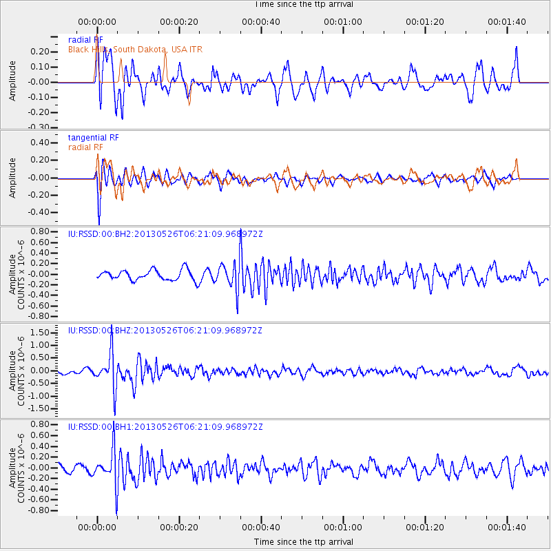
RSSD Black Hills, South Dakota, USA - Earthquake Result Viewer
*The percent match for this event was below the threshold and hence no stack was calculated.
| Earthquake location: |
Southeastern Uzbekistan |
| Earthquake latitude/longitude: |
40.0/67.3 |
| Earthquake time(UTC): |
2013/05/26 (146) 06:08:15 GMT |
| Earthquake Depth: |
18 km |
| Earthquake Magnitude: |
5.7 MW, 5.6 MW, 5.9 MS, 6.2 MB |
| Earthquake Catalog/Contributor: |
NEIC PDE/NEIC PDE-W |
|
| Network: |
IU Global Seismograph Network (GSN - IRIS/USGS) |
| Station: |
RSSD Black Hills, South Dakota, USA |
| Lat/Lon: |
44.12 N/104.04 W |
| Elevation: |
2090 m |
|
| Distance: |
95.9 deg |
| Az: |
353.748 deg |
| Baz: |
6.675 deg |
| Ray Param: |
$rayparam |
*The percent match for this event was below the threshold and hence was not used in the summary stack. |
|
| Radial Match: |
74.97303 % |
| Radial Bump: |
400 |
| Transverse Match: |
70.72863 % |
| Transverse Bump: |
330 |
| SOD ConfigId: |
512894 |
| Insert Time: |
2013-09-14 20:14:03.760 +0000 |
| GWidth: |
2.5 |
| Max Bumps: |
400 |
| Tol: |
0.001 |
|
Signal To Noise
| Channel | StoN | STA | LTA |
| IU:RSSD:00:BHZ:20130526T06:21:09.968972Z | 5.954767 | 7.007483E-7 | 1.1767853E-7 |
| IU:RSSD:00:BH1:20130526T06:21:09.968972Z | 2.8430774 | 3.234583E-7 | 1.1377049E-7 |
| IU:RSSD:00:BH2:20130526T06:21:09.968972Z | 2.6069763 | 2.5300514E-7 | 9.704927E-8 |
| Arrivals |
| Ps | |
| PpPs | |
| PsPs/PpSs | |


