You are here: Home > Network List > GS - US Geological Survey Networks Stations List
> Station KAN10 Keim Farm > Earthquake Result Viewer
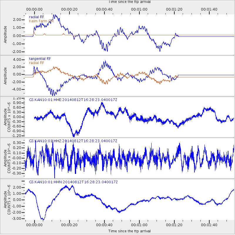
KAN10 Keim Farm - Earthquake Result Viewer
*The percent match for this event was below the threshold and hence no stack was calculated.
| Earthquake location: |
Samoa Islands Region |
| Earthquake latitude/longitude: |
-17.0/-172.9 |
| Earthquake time(UTC): |
2014/08/12 (224) 16:16:02 GMT |
| Earthquake Depth: |
10 km |
| Earthquake Magnitude: |
5.3 MW, 5.0 mb |
| Earthquake Catalog/Contributor: |
ISC/ISC |
|
| Network: |
GS US Geological Survey Networks |
| Station: |
KAN10 Keim Farm |
| Lat/Lon: |
37.12 N/98.10 W |
| Elevation: |
417 m |
|
| Distance: |
88.5 deg |
| Az: |
50.485 deg |
| Baz: |
247.483 deg |
| Ray Param: |
$rayparam |
*The percent match for this event was below the threshold and hence was not used in the summary stack. |
|
| Radial Match: |
43.896667 % |
| Radial Bump: |
400 |
| Transverse Match: |
51.310272 % |
| Transverse Bump: |
400 |
| SOD ConfigId: |
3390531 |
| Insert Time: |
2019-04-13 08:15:06.301 +0000 |
| GWidth: |
2.5 |
| Max Bumps: |
400 |
| Tol: |
0.001 |
|
Signal To Noise
| Channel | StoN | STA | LTA |
| GS:KAN10:01:HHZ:20140812T16:28:23.040017Z | 1.5765079 | 1.5383047E-7 | 9.757672E-8 |
| GS:KAN10:01:HHN:20140812T16:28:23.040017Z | 2.4007647 | 1.636608E-6 | 6.817028E-7 |
| GS:KAN10:01:HHE:20140812T16:28:23.040017Z | 1.1849829 | 5.014389E-7 | 4.2316128E-7 |
| Arrivals |
| Ps | |
| PpPs | |
| PsPs/PpSs | |


