You are here: Home > Network List > II - Global Seismograph Network (GSN - IRIS/IDA) Stations List
> Station TAU Hobart, Tasmania, Australia > Earthquake Result Viewer
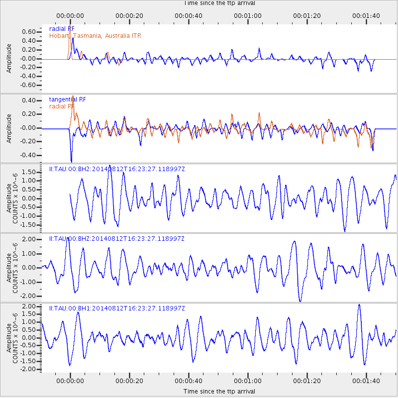
TAU Hobart, Tasmania, Australia - Earthquake Result Viewer
*The percent match for this event was below the threshold and hence no stack was calculated.
| Earthquake location: |
Samoa Islands Region |
| Earthquake latitude/longitude: |
-17.0/-172.9 |
| Earthquake time(UTC): |
2014/08/12 (224) 16:16:02 GMT |
| Earthquake Depth: |
10 km |
| Earthquake Magnitude: |
5.3 MW, 5.0 mb |
| Earthquake Catalog/Contributor: |
ISC/ISC |
|
| Network: |
II Global Seismograph Network (GSN - IRIS/IDA) |
| Station: |
TAU Hobart, Tasmania, Australia |
| Lat/Lon: |
42.91 S/147.32 E |
| Elevation: |
132 m |
|
| Distance: |
42.6 deg |
| Az: |
224.088 deg |
| Baz: |
65.006 deg |
| Ray Param: |
$rayparam |
*The percent match for this event was below the threshold and hence was not used in the summary stack. |
|
| Radial Match: |
62.345516 % |
| Radial Bump: |
400 |
| Transverse Match: |
58.94031 % |
| Transverse Bump: |
400 |
| SOD ConfigId: |
3390531 |
| Insert Time: |
2019-04-13 08:15:22.897 +0000 |
| GWidth: |
2.5 |
| Max Bumps: |
400 |
| Tol: |
0.001 |
|
Signal To Noise
| Channel | StoN | STA | LTA |
| II:TAU:00:BHZ:20140812T16:23:27.118997Z | 1.7861124 | 1.2950004E-6 | 7.2503855E-7 |
| II:TAU:00:BH1:20140812T16:23:27.118997Z | 2.5663784 | 1.1365944E-6 | 4.4287876E-7 |
| II:TAU:00:BH2:20140812T16:23:27.118997Z | 0.67234534 | 5.5307873E-7 | 8.226111E-7 |
| Arrivals |
| Ps | |
| PpPs | |
| PsPs/PpSs | |


