You are here: Home > Network List > TA - USArray Transportable Network (new EarthScope stations) Stations List
> Station E43A Lone Tree Farm, Eben Junction, MI, USA > Earthquake Result Viewer
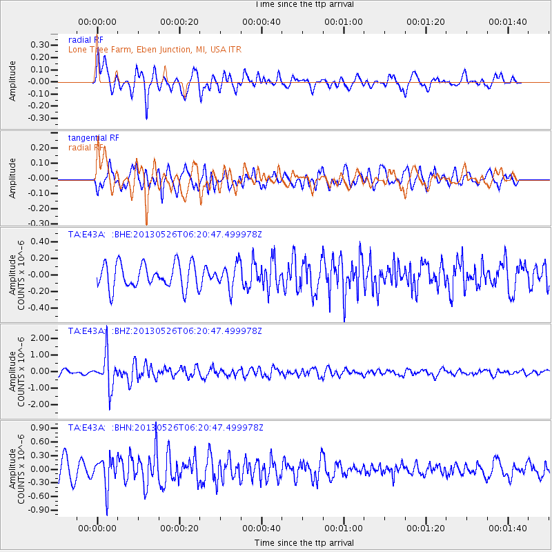
E43A Lone Tree Farm, Eben Junction, MI, USA - Earthquake Result Viewer
*The percent match for this event was below the threshold and hence no stack was calculated.
| Earthquake location: |
Southeastern Uzbekistan |
| Earthquake latitude/longitude: |
40.0/67.3 |
| Earthquake time(UTC): |
2013/05/26 (146) 06:08:15 GMT |
| Earthquake Depth: |
18 km |
| Earthquake Magnitude: |
5.7 MW, 5.6 MW, 5.9 MS, 6.2 MB |
| Earthquake Catalog/Contributor: |
NEIC PDE/NEIC PDE-W |
|
| Network: |
TA USArray Transportable Network (new EarthScope stations) |
| Station: |
E43A Lone Tree Farm, Eben Junction, MI, USA |
| Lat/Lon: |
46.38 N/87.00 W |
| Elevation: |
303 m |
|
| Distance: |
91.0 deg |
| Az: |
342.531 deg |
| Baz: |
19.468 deg |
| Ray Param: |
$rayparam |
*The percent match for this event was below the threshold and hence was not used in the summary stack. |
|
| Radial Match: |
76.253235 % |
| Radial Bump: |
400 |
| Transverse Match: |
53.175148 % |
| Transverse Bump: |
400 |
| SOD ConfigId: |
512894 |
| Insert Time: |
2013-09-14 20:21:13.762 +0000 |
| GWidth: |
2.5 |
| Max Bumps: |
400 |
| Tol: |
0.001 |
|
Signal To Noise
| Channel | StoN | STA | LTA |
| TA:E43A: :BHZ:20130526T06:20:47.499978Z | 6.339137 | 1.0401657E-6 | 1.6408632E-7 |
| TA:E43A: :BHN:20130526T06:20:47.499978Z | 1.5805283 | 3.2362075E-7 | 2.0475481E-7 |
| TA:E43A: :BHE:20130526T06:20:47.499978Z | 1.0178463 | 1.4998491E-7 | 1.4735517E-7 |
| Arrivals |
| Ps | |
| PpPs | |
| PsPs/PpSs | |


