You are here: Home > Network List > TA - USArray Transportable Network (new EarthScope stations) Stations List
> Station L43A Garden Prairie, IL, USA > Earthquake Result Viewer
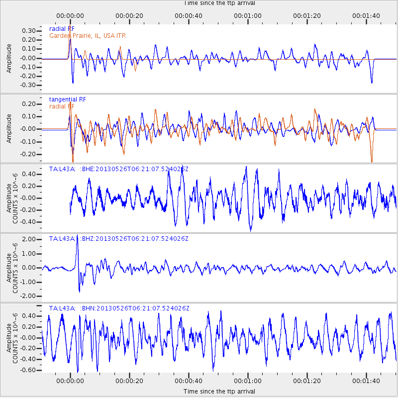
L43A Garden Prairie, IL, USA - Earthquake Result Viewer
*The percent match for this event was below the threshold and hence no stack was calculated.
| Earthquake location: |
Southeastern Uzbekistan |
| Earthquake latitude/longitude: |
40.0/67.3 |
| Earthquake time(UTC): |
2013/05/26 (146) 06:08:15 GMT |
| Earthquake Depth: |
18 km |
| Earthquake Magnitude: |
5.7 MW, 5.6 MW, 5.9 MS, 6.2 MB |
| Earthquake Catalog/Contributor: |
NEIC PDE/NEIC PDE-W |
|
| Network: |
TA USArray Transportable Network (new EarthScope stations) |
| Station: |
L43A Garden Prairie, IL, USA |
| Lat/Lon: |
42.18 N/88.74 W |
| Elevation: |
266 m |
|
| Distance: |
95.4 deg |
| Az: |
342.363 deg |
| Baz: |
18.261 deg |
| Ray Param: |
$rayparam |
*The percent match for this event was below the threshold and hence was not used in the summary stack. |
|
| Radial Match: |
45.614876 % |
| Radial Bump: |
351 |
| Transverse Match: |
54.09462 % |
| Transverse Bump: |
400 |
| SOD ConfigId: |
512894 |
| Insert Time: |
2013-09-14 20:27:06.138 +0000 |
| GWidth: |
2.5 |
| Max Bumps: |
400 |
| Tol: |
0.001 |
|
Signal To Noise
| Channel | StoN | STA | LTA |
| TA:L43A: :BHZ:20130526T06:21:07.524026Z | 5.949948 | 8.666701E-7 | 1.4566012E-7 |
| TA:L43A: :BHN:20130526T06:21:07.524026Z | 1.0560435 | 2.9032162E-7 | 2.7491444E-7 |
| TA:L43A: :BHE:20130526T06:21:07.524026Z | 1.4276831 | 1.8358655E-7 | 1.2859054E-7 |
| Arrivals |
| Ps | |
| PpPs | |
| PsPs/PpSs | |


