You are here: Home > Network List > IW - Intermountain West Stations List
> Station MOOW Moose Ponds, Wyoming, USA > Earthquake Result Viewer
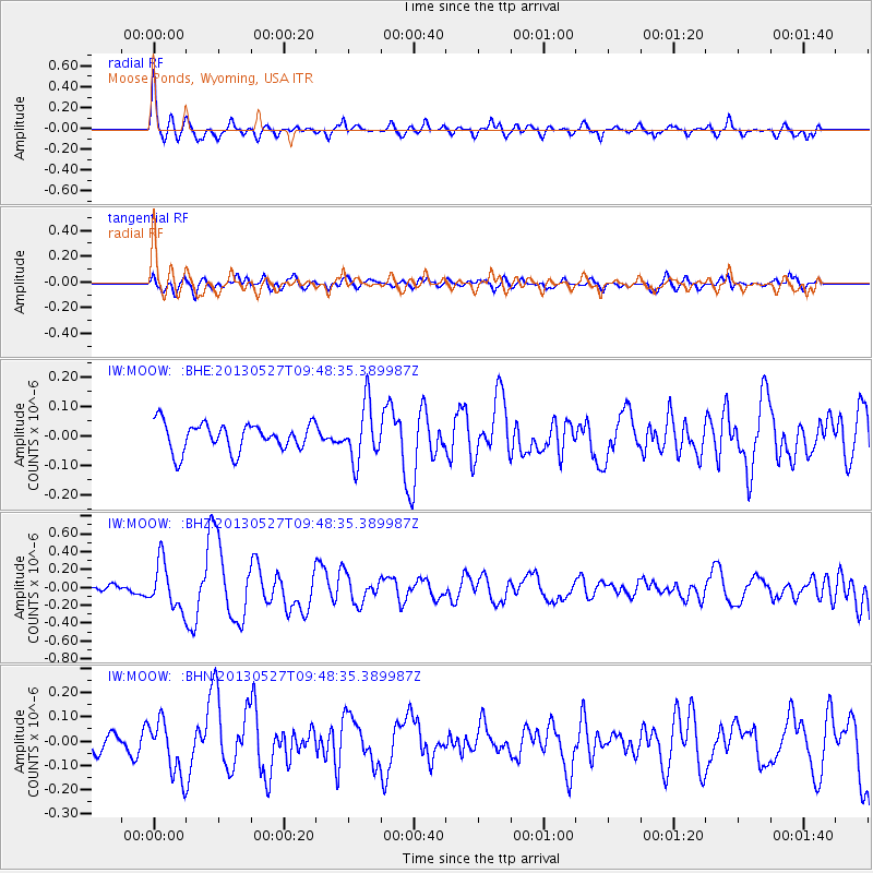
MOOW Moose Ponds, Wyoming, USA - Earthquake Result Viewer
*The percent match for this event was below the threshold and hence no stack was calculated.
| Earthquake location: |
Panama-Costa Rica Border Region |
| Earthquake latitude/longitude: |
9.4/-82.6 |
| Earthquake time(UTC): |
2013/05/27 (147) 09:41:14 GMT |
| Earthquake Depth: |
9.2 km |
| Earthquake Magnitude: |
5.7 MW, 5.6 MB, 5.7 MW |
| Earthquake Catalog/Contributor: |
NEIC PDE/NEIC PDE-W |
|
| Network: |
IW Intermountain West |
| Station: |
MOOW Moose Ponds, Wyoming, USA |
| Lat/Lon: |
43.75 N/110.74 W |
| Elevation: |
2128 m |
|
| Distance: |
42.0 deg |
| Az: |
329.344 deg |
| Baz: |
136.034 deg |
| Ray Param: |
$rayparam |
*The percent match for this event was below the threshold and hence was not used in the summary stack. |
|
| Radial Match: |
76.18226 % |
| Radial Bump: |
400 |
| Transverse Match: |
69.54696 % |
| Transverse Bump: |
400 |
| SOD ConfigId: |
512894 |
| Insert Time: |
2013-09-14 20:58:29.881 +0000 |
| GWidth: |
2.5 |
| Max Bumps: |
400 |
| Tol: |
0.001 |
|
Signal To Noise
| Channel | StoN | STA | LTA |
| IW:MOOW: :BHZ:20130527T09:48:35.389987Z | 5.355714 | 2.5499816E-7 | 4.7612357E-8 |
| IW:MOOW: :BHN:20130527T09:48:35.389987Z | 2.6582086 | 1.1206992E-7 | 4.2159943E-8 |
| IW:MOOW: :BHE:20130527T09:48:35.389987Z | 2.031289 | 9.6032835E-8 | 4.7276792E-8 |
| Arrivals |
| Ps | |
| PpPs | |
| PsPs/PpSs | |


