You are here: Home > Network List > TA - USArray Transportable Network (new EarthScope stations) Stations List
> Station R11A Troy Canyon, Currant, NV, USA > Earthquake Result Viewer
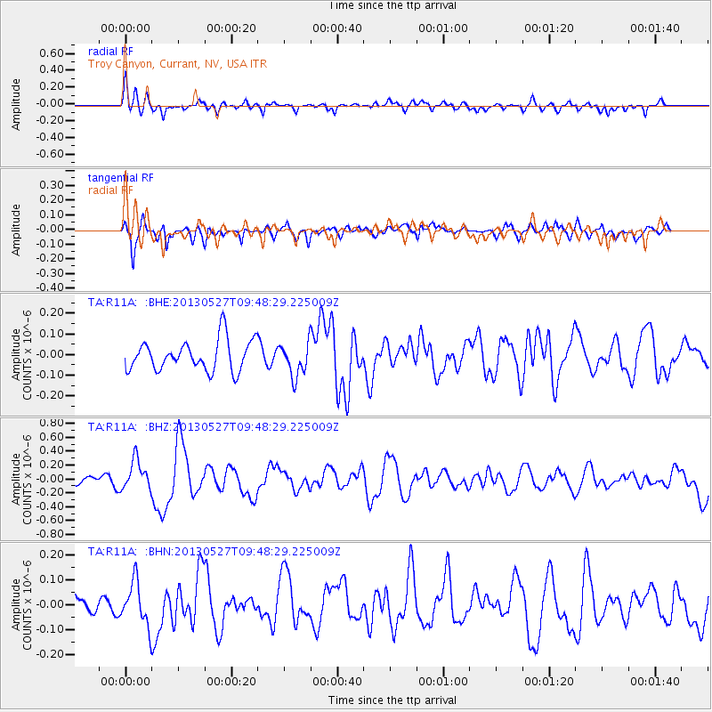
R11A Troy Canyon, Currant, NV, USA - Earthquake Result Viewer
*The percent match for this event was below the threshold and hence no stack was calculated.
| Earthquake location: |
Panama-Costa Rica Border Region |
| Earthquake latitude/longitude: |
9.4/-82.6 |
| Earthquake time(UTC): |
2013/05/27 (147) 09:41:14 GMT |
| Earthquake Depth: |
9.2 km |
| Earthquake Magnitude: |
5.7 MW, 5.6 MB, 5.7 MW |
| Earthquake Catalog/Contributor: |
NEIC PDE/NEIC PDE-W |
|
| Network: |
TA USArray Transportable Network (new EarthScope stations) |
| Station: |
R11A Troy Canyon, Currant, NV, USA |
| Lat/Lon: |
38.35 N/115.59 W |
| Elevation: |
1756 m |
|
| Distance: |
41.3 deg |
| Az: |
319.598 deg |
| Baz: |
125.573 deg |
| Ray Param: |
$rayparam |
*The percent match for this event was below the threshold and hence was not used in the summary stack. |
|
| Radial Match: |
71.667206 % |
| Radial Bump: |
400 |
| Transverse Match: |
75.30365 % |
| Transverse Bump: |
400 |
| SOD ConfigId: |
512894 |
| Insert Time: |
2013-09-14 21:15:12.619 +0000 |
| GWidth: |
2.5 |
| Max Bumps: |
400 |
| Tol: |
0.001 |
|
Signal To Noise
| Channel | StoN | STA | LTA |
| TA:R11A: :BHZ:20130527T09:48:29.225009Z | 2.3571599 | 2.140828E-7 | 9.0822354E-8 |
| TA:R11A: :BHN:20130527T09:48:29.225009Z | 1.9037364 | 8.801305E-8 | 4.6231744E-8 |
| TA:R11A: :BHE:20130527T09:48:29.225009Z | 1.1047302 | 8.1504666E-8 | 7.377788E-8 |
| Arrivals |
| Ps | |
| PpPs | |
| PsPs/PpSs | |


