You are here: Home > Network List > US - United States National Seismic Network Stations List
> Station DGMT Dagmar, Montana, USA > Earthquake Result Viewer
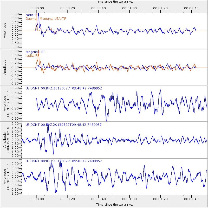
DGMT Dagmar, Montana, USA - Earthquake Result Viewer
*The percent match for this event was below the threshold and hence no stack was calculated.
| Earthquake location: |
Panama-Costa Rica Border Region |
| Earthquake latitude/longitude: |
9.4/-82.6 |
| Earthquake time(UTC): |
2013/05/27 (147) 09:41:14 GMT |
| Earthquake Depth: |
9.2 km |
| Earthquake Magnitude: |
5.7 MW, 5.6 MB, 5.7 MW |
| Earthquake Catalog/Contributor: |
NEIC PDE/NEIC PDE-W |
|
| Network: |
US United States National Seismic Network |
| Station: |
DGMT Dagmar, Montana, USA |
| Lat/Lon: |
48.47 N/104.20 W |
| Elevation: |
0.0 m |
|
| Distance: |
42.9 deg |
| Az: |
338.966 deg |
| Baz: |
147.848 deg |
| Ray Param: |
$rayparam |
*The percent match for this event was below the threshold and hence was not used in the summary stack. |
|
| Radial Match: |
71.17742 % |
| Radial Bump: |
343 |
| Transverse Match: |
56.7944 % |
| Transverse Bump: |
400 |
| SOD ConfigId: |
512894 |
| Insert Time: |
2013-09-14 21:16:05.568 +0000 |
| GWidth: |
2.5 |
| Max Bumps: |
400 |
| Tol: |
0.001 |
|
Signal To Noise
| Channel | StoN | STA | LTA |
| US:DGMT:00:BHZ:20130527T09:48:42.748995Z | 3.8368113 | 4.7800347E-7 | 1.2458352E-7 |
| US:DGMT:00:BH1:20130527T09:48:42.748995Z | 1.1466893 | 2.2224471E-7 | 1.9381423E-7 |
| US:DGMT:00:BH2:20130527T09:48:42.748995Z | 1.7413865 | 3.3916592E-7 | 1.9476774E-7 |
| Arrivals |
| Ps | |
| PpPs | |
| PsPs/PpSs | |


