You are here: Home > Network List > TA - USArray Transportable Network (new EarthScope stations) Stations List
> Station MSTX Muleshoe, TX, USA > Earthquake Result Viewer
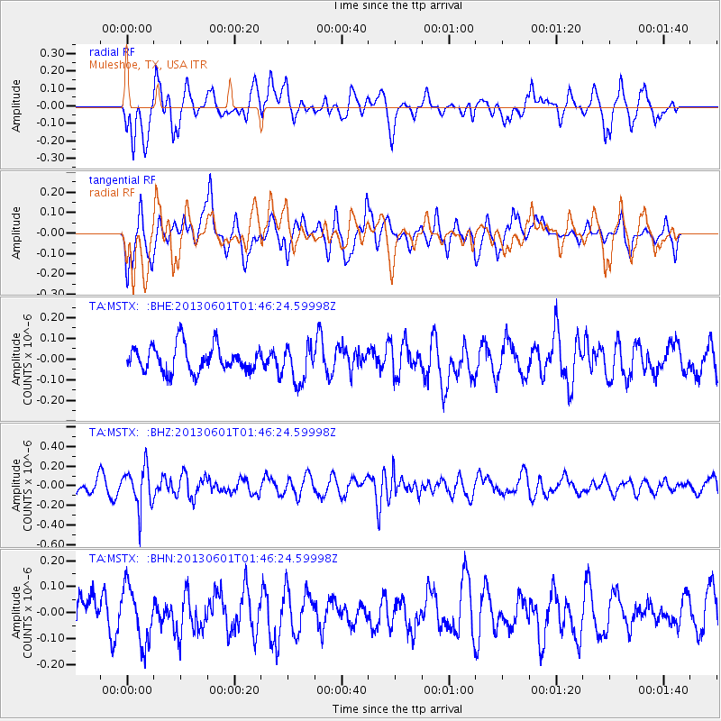
MSTX Muleshoe, TX, USA - Earthquake Result Viewer
*The percent match for this event was below the threshold and hence no stack was calculated.
| Earthquake location: |
South Of Fiji Islands |
| Earthquake latitude/longitude: |
-23.1/-177.2 |
| Earthquake time(UTC): |
2013/06/01 (152) 01:34:14 GMT |
| Earthquake Depth: |
185 km |
| Earthquake Magnitude: |
5.5 MB |
| Earthquake Catalog/Contributor: |
NEIC PDE/NEIC PDE-W |
|
| Network: |
TA USArray Transportable Network (new EarthScope stations) |
| Station: |
MSTX Muleshoe, TX, USA |
| Lat/Lon: |
33.97 N/102.77 W |
| Elevation: |
1167 m |
|
| Distance: |
90.6 deg |
| Az: |
53.183 deg |
| Baz: |
242.525 deg |
| Ray Param: |
$rayparam |
*The percent match for this event was below the threshold and hence was not used in the summary stack. |
|
| Radial Match: |
57.333916 % |
| Radial Bump: |
400 |
| Transverse Match: |
49.155624 % |
| Transverse Bump: |
400 |
| SOD ConfigId: |
512894 |
| Insert Time: |
2013-09-14 21:53:42.318 +0000 |
| GWidth: |
2.5 |
| Max Bumps: |
400 |
| Tol: |
0.001 |
|
Signal To Noise
| Channel | StoN | STA | LTA |
| TA:MSTX: :BHZ:20130601T01:46:24.59998Z | 3.1243927 | 2.0925432E-7 | 6.6974394E-8 |
| TA:MSTX: :BHN:20130601T01:46:24.59998Z | 1.6781191 | 1.07945795E-7 | 6.432547E-8 |
| TA:MSTX: :BHE:20130601T01:46:24.59998Z | 1.4080745 | 8.9195076E-8 | 6.3345425E-8 |
| Arrivals |
| Ps | |
| PpPs | |
| PsPs/PpSs | |


