You are here: Home > Network List > TA - USArray Transportable Network (new EarthScope stations) Stations List
> Station N23A Red Feather Lakes, CO, USA > Earthquake Result Viewer
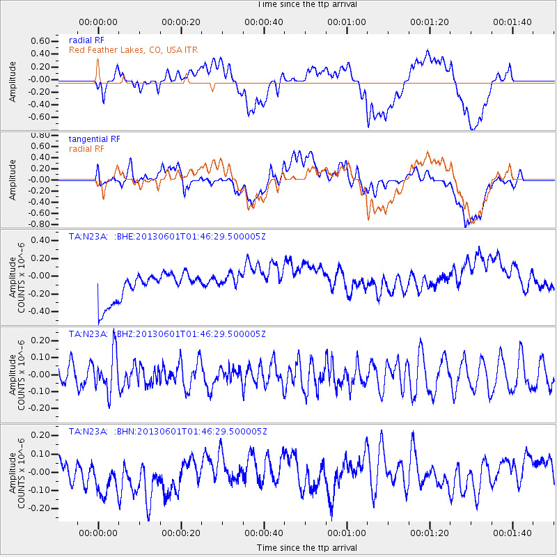
N23A Red Feather Lakes, CO, USA - Earthquake Result Viewer
*The percent match for this event was below the threshold and hence no stack was calculated.
| Earthquake location: |
South Of Fiji Islands |
| Earthquake latitude/longitude: |
-23.1/-177.2 |
| Earthquake time(UTC): |
2013/06/01 (152) 01:34:14 GMT |
| Earthquake Depth: |
185 km |
| Earthquake Magnitude: |
5.5 MB |
| Earthquake Catalog/Contributor: |
NEIC PDE/NEIC PDE-W |
|
| Network: |
TA USArray Transportable Network (new EarthScope stations) |
| Station: |
N23A Red Feather Lakes, CO, USA |
| Lat/Lon: |
40.89 N/105.94 W |
| Elevation: |
2458 m |
|
| Distance: |
91.7 deg |
| Az: |
45.9 deg |
| Baz: |
240.749 deg |
| Ray Param: |
$rayparam |
*The percent match for this event was below the threshold and hence was not used in the summary stack. |
|
| Radial Match: |
40.03402 % |
| Radial Bump: |
400 |
| Transverse Match: |
40.107796 % |
| Transverse Bump: |
400 |
| SOD ConfigId: |
512894 |
| Insert Time: |
2013-09-14 21:53:46.884 +0000 |
| GWidth: |
2.5 |
| Max Bumps: |
400 |
| Tol: |
0.001 |
|
Signal To Noise
| Channel | StoN | STA | LTA |
| TA:N23A: :BHZ:20130601T01:46:29.500005Z | 2.110731 | 1.1580664E-7 | 5.4865655E-8 |
| TA:N23A: :BHN:20130601T01:46:29.500005Z | 2.583614 | 1.4554753E-7 | 5.6334855E-8 |
| TA:N23A: :BHE:20130601T01:46:29.500005Z | 0.68132323 | 1.0576856E-7 | 1.5523992E-7 |
| Arrivals |
| Ps | |
| PpPs | |
| PsPs/PpSs | |


